The impacts of Hurricane Lowell, along with separate weather events across the Pacific and Europe, highlight a period of intense atmospheric activity. The storm affected Ni‘ihau, Kauaʻi and O‘ahu, while Japan and parts of Europe dealt with flooding linked to unstable weather conditions.
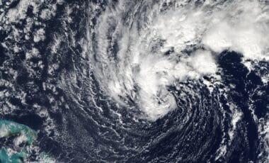
Hurricane Lowell moved close to Hawaii’s western islands on Tuesday night, with its centre passing about 50 miles (80km) from Ni‘ihau in Kauai county. The storm reached category 2 strength, producing winds of up to 110mph and causing widespread power outages across Ni‘ihau, Kauaʻi and O‘ahu.
Hurricane Lowell Brings Strong Winds and Rare Tornado Watch to Hawaii
The storm was notable for a tornado watch issued for Kauaʻi from Monday night into Tuesday morning. According to research maps from Iowa State University, the alert was likely the first tornado watch issued in Hawaii’s history. A tornado was not documented during the event, though hurricanes can produce tornadoes, which most often form inside thunderstorms within rain bands away from the centre of the system.
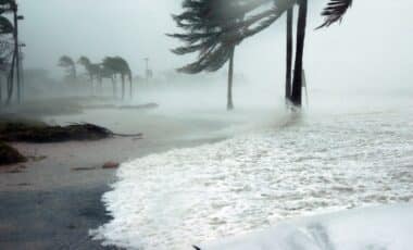
According to the National Weather Service, five named storms have occurred in the central Pacific this year, with a strong El Niño identified as a key factor behind the above-normal hurricane season. Hurricane Lowell’s effects included coastal impacts, with large waves reported along the western side of Hawaii’s Oʻahu island.
The storm’s passage added to a season marked by increased tropical activity in the central Pacific, where weather agencies have continued monitoring developing systems and their potential effects on nearby islands.
Japan and Europe Face Flooding After Heavy Rainfall Events
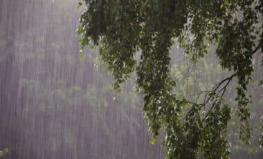
In Japan, further heavy rainfall caused flooding on roads and subway stations, disrupting transport services including the Tokaido Shinkansen bullet train. A record-breaking 104.5mm of rain fell within one hour in Nagoya on Tuesday afternoon.
The rainfall developed as a stationary front combined with a moist air mass linked to tropical depression Krovanh, creating very unstable conditions. According to the reported weather information, a level-two landslide advisory remained in place across Japan on Friday.
Several landslides had already occurred, including one near a main starting point for Mount Fuji on Wednesday, where debris covered three vehicles. No injuries or fatalities were reported.
Heavy rainfall also affected parts of central-southern Europe during the same period. Cooler air moved south-east across much of the continent earlier in the week, replacing the warm air mass connected to a late-season heatwave in southern Europe. The resulting cold front reached the Mediterranean by Wednesday.
The interaction between cooler air and unusually warm Mediterranean waters helped create conditions for thunderstorms around Corsica, Sardinia and northern Italy. The storms produced torrential rainfall, flash flooding, strong winds and some tornadoes.
According to weather station data from Veneto, 154.2mm of rain was recorded in 3.5 hours. The storms later moved towards Austria and the Balkans, with some expected to continue into Friday. Drier and sunnier conditions were forecast to return to the region over the weekend and into the start of the following week.