A powerful low-pressure system sweeping in from Greenland will deliver torrential rain and gale-force winds this week before a sharp polar blast plunges temperatures and brings snow to higher ground.
The United Kingdom is heading into a volatile stretch of weather that will test the patience of anyone hoping spring had finally arrived. A brief window of mild, almost pleasant conditions mid-week will give way abruptly to a wintry assault by the end of the week, as forecasters warn of a dramatic shift in air mass that will make Friday feel more like January than March.
The pattern reflects a familiar tension in British meteorology at this time of year, the jet stream, still energized across the North Atlantic, remains powerful enough to drag both warmth and Arctic cold into the same week. For many parts of the country, the transition will be sharp and disruptive, with western counties likely to bear the brunt of the initial deluge before colder air takes hold nationwide.
A Warm Sector First, Then the Deluge
Before winter reasserts itself, Britain will first be wrapped in what meteorologists describe as a “warm sector”, a band of mild, rain-laden air preceding the cold front. Temperatures are expected to reach 12°C to 13°C across much of the country on Thursday, briefly touching the mid-teens in some areas. But the warmth will come at a cost.
According to Met Office meteorologist Annie Shuttleworth, Thursday will be the wettest day of the week for most of the country. “We get stuck in a warm sector on Thursday, and that is going to be the wettest day of the week for many of us,” she said. Western counties, which have already endured relentless rainfall through the winter months, are once again in the firing line for significant accumulations.
A large low-pressure system anchored close to Greenland is driving the pattern, with the jet stream accelerating a series of storms across the Atlantic toward Britain from mid-week onward. Winds could reach 60 to 70mph across the far north on Wednesday, raising the prospect of disruption to travel and infrastructure.
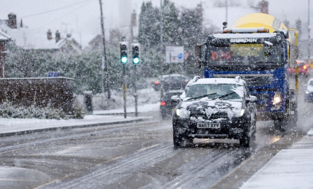
Arctic Air Returns With Snow and Frost
The mild interlude will be short-lived. Behind the warm front, a markedly colder airmass is set to push south, delivering a notable change in conditions by Friday. Jason Kelly, chief operational meteorologist for the Met Office, described Friday as bringing “a mixture of sunny spells, heavy showers, coastal gales, and snow over high ground,” with the possibility of accumulations on lower hills as well.
Snow is considered most likely over the Scottish hills, though forecasters have not ruled out flurries to lower elevations. Frost is expected in sheltered areas overnight, according to Shuttleworth, who noted that the shift will bring “a very different feel in the weather.” The deterioration is forecast to continue into the weekend, with conditions turning wetter and windier once again.
Jim Dale, meteorologist for British Weather Services and co-author of Surviving Extreme Weather, offered a blunt assessment: “Spring is on hold at the end of the week, and we are going to go back into winter. We are never out of the woods this early in spring, and the next few days will be an example of that.”