The main areas of concern include California, the Gulf Coast, the Southeast and parts of the Northeast. Forecasters stress that regional effects remain uncertain, even during powerful El Niño episodes, because other atmospheric and climate conditions can alter how the pattern develops.
Why Forecasters Expect El Niño to Intensify
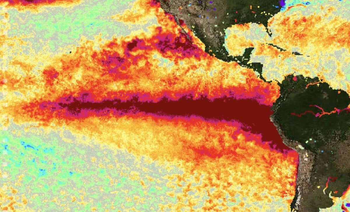
El Niño occurs when sea-surface temperatures in the central and eastern tropical Pacific rise above average. These warmer waters affect atmospheric circulation, shifting the jet stream and changing where storms form and travel.
The term “super El Niño” is used informally by some meteorologists for an exceptionally strong event, generally when ocean temperature anomalies exceed about 2 degrees Celsius. NOAA does not use that classification and instead describes the developing pattern as having the potential to become “very strong”.
According to NOAA’s Climate Prediction Center, there is an 81 per cent chance of a very strong El Niño developing between October and December. Peak intensity is expected in late autumn or early winter, while the agency estimates a 97 per cent chance that El Niño will continue into early spring 2027.
Forecast models also point towards continued strengthening. NOAA’s Geophysical Fluid Dynamics Laboratory reported that all 30 members of its experimental SPEAR forecast ensemble project a very strong event later in 2026. Each forecast member reaches a level at least competitive with the strongest El Niño episodes observed during the past century.
Scientists are also monitoring a large store of unusually warm water beneath the Pacific Ocean’s surface. According to NOAA, that subsurface heat is supporting further development, while changes in tropical Pacific winds suggest that the ocean and atmosphere are becoming more closely linked.
Even so, a strong event does not guarantee the same weather in every place. The Climate Prediction Center said stronger El Niño conditions can tilt the odds towards typical outcomes, but those effects do not occur uniformly.
Which States Face the Greatest Winter Risks
Strong El Niño winters often bring wetter conditions to parts of the southern United States and California. They can also increase the likelihood of warmer-than-average weather across sections of the northern tier.
California is closely watched because a stronger Pacific jet stream can direct winter storms towards the state. Southern California may experience significant rainfall, while the central Sierra Nevada could receive substantially more snow.
Across Mississippi, Alabama, Georgia and South Carolina, the main concerns are heavy rainfall and cooler fronts. Florida may face a greater likelihood of severe winter storms, including tornadoes.
According to National Weather Service duty officer Mark Wiley, the risks of flash flooding, river flooding and severe weather would rise, with the greatest tornado threat generally extending across the Deep South, the Gulf Coast and Florida. A strong El Niño can also increase the possibility of winter precipitation in the South when enough cold air is present, particularly freezing rain.
New York, Vermont and New Hampshire may experience heavy rain and significant snowfall. By contrast, parts of the northern United States and the Pacific Northwest often see warmer and relatively drier conditions, although outcomes vary from year to year.
The effects may also extend offshore. According to USA Today, warmer Pacific waters can draw species such as mahi mahi, bluefin tuna, sea turtles, stingrays and juvenile white sharks farther north, while disrupting the cold, nutrient-rich upwelling that supports California’s coastal food chain.
Forecasters will continue monitoring Pacific temperatures, wind patterns and atmospheric responses before more detailed winter outlooks become available. Emergency managers, water agencies and weather offices in vulnerable states are already watching how the 2026-27 event develops.