
The forecast points to a combination of rain, strengthening winds and colder conditions across several regions. Weather charts also indicate that the unsettled spell could continue into Wednesday, while snow remains possible on higher ground in northern parts of Britain.
Weather Maps Identify Five Areas Facing the Heaviest Rainfall
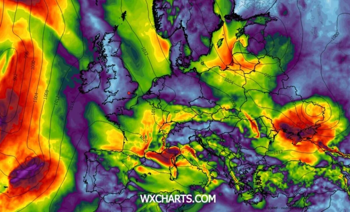
According to WXCharts, heavy rain and strong winds are expected to move towards Britain on Tuesday, 17 November, with western regions particularly exposed to the approaching weather system. The charts indicate gusts of around 60mph around Britain and Ireland, with further strong winds possible on Wednesday, 18 November.
Five areas stand out in the rainfall forecasts: western Scotland, North Wales, South Wales, south-west England and parts of western England. These locations could receive some of the heaviest rainfall during the unsettled period, although the maps suggest that conditions will vary considerably between regions.
The forecasts also indicate rainfall across wider parts of England, Scotland and Wales. While some areas could experience substantial amounts of rain, others may see less pronounced conditions as the weather moves across the country.
A separate WXCharts map covering Wednesday highlights western Britain as an area where rainfall could accumulate over several days. The figures shown on these charts represent totals across a longer period, rather than the amount of rain expected to fall during Tuesday alone.
This distinction matters when interpreting the maps, as the accumulated rainfall figures do not describe a single day’s conditions. They instead illustrate how wet weather could develop across different parts of Britain during the coming days.
Met Office Forecasts Stronger Winds, Changeable Weather and Possible Snow
The Met Office has also indicated that rain and strengthening winds will move into south-west Britain on Monday, 16 November, following a cold start to the week. This marks the beginning of a period of unsettled conditions expected to affect several parts of the country.
According to the Met Office, the weather is expected to remain changeable between Tuesday and Thursday. Alongside the rain and strong winds, snow could develop on higher ground in North Wales, northern England and Scotland.
Strong gusts could create difficult driving conditions, particularly along exposed roads and in coastal areas. The combination of wet weather and strengthening winds may also make journeys more challenging in regions experiencing the most severe conditions.
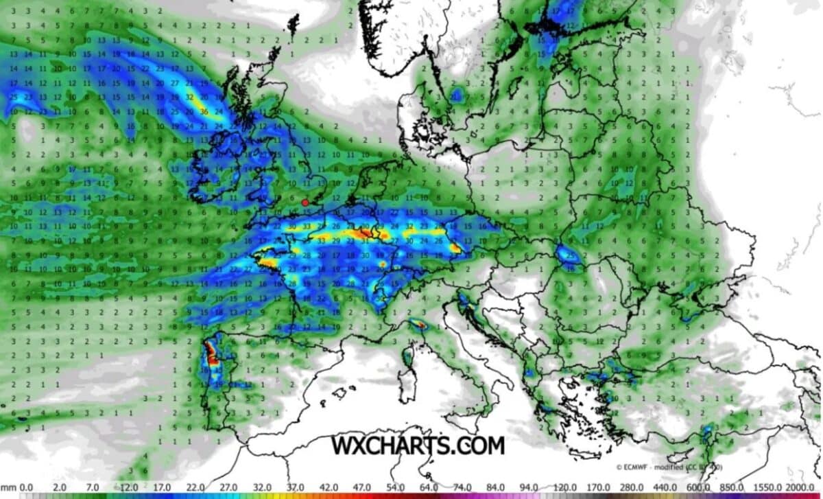
The forecasts suggest that western parts of Britain will be among the areas most affected by rainfall, while the wind charts show stronger gusts around Britain and Ireland during Tuesday and Wednesday.
Although the rainfall maps identify several potentially wetter regions, they do not indicate that every location will experience identical conditions. The extent of the rain and the strength of the winds are expected to differ between areas.
For people travelling during the week, the main concern is the combination of heavy rainfall and strong winds. With unsettled weather forecast through Thursday and snow possible at higher elevations, conditions could remain difficult across parts of Britain for several days.