
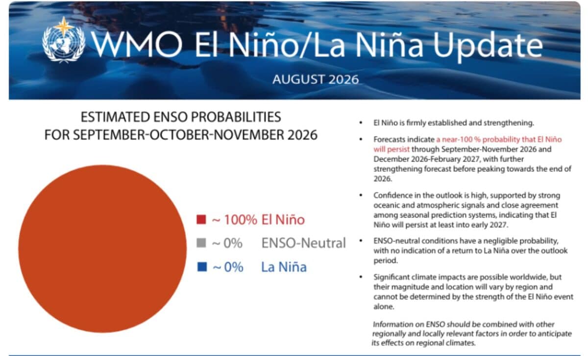
The World Meteorological Organization (WMO) said the likelihood of El Niño persisting through February 2027 is close to 100 per cent, according to its latest update. The organisation said exceptionally warm ocean conditions are driving the development of a very strong event, increasing the risk of extreme weather in many regions.
Pacific Ocean Warming Drives an Unusually Strong Climate Pattern
El Niño develops when sea surface temperatures in the central and eastern tropical Pacific become unusually warm. The phenomenon normally occurs every two to seven years and lasts around nine to twelve months, affecting atmospheric circulation and shifting weather patterns far from the Pacific.
Measurements show that the current event has gained strength rapidly. According to the WMO, the Niño 3.4 index, which tracks sea surface temperature changes in a key area of the tropical Pacific, reached around 2°C above average in July 2026. Weekly values later increased further, reaching approximately 2.2°C to 2.6°C above average between late July and mid-August.
The heat is also extending below the ocean surface. In some areas, subsurface temperatures were more than 8°C above average during July and early August, providing additional energy for the developing event.
Scientists have noted that El Niño remains a natural climate cycle and that its relationship with human-caused warming is still being studied. The current event is occurring as global ocean temperatures remain unusually high, creating a warmer background for its impacts.
Global Impacts Expected to Vary Across Regions
A very strong El Niño does not produce identical effects everywhere. Its influence depends on location, season and other climate factors, including conditions in the Indian and Atlantic Oceans.
According to the WMO, forecasts for September to November 2026 indicate a higher likelihood of above-normal temperatures across almost all land areas. Rainfall patterns are also expected to show typical El Niño influences, with some regions facing increased risks of drought while others may experience heavier rainfall.
Parts of Southeast Asia, Central America and northern areas of South America are among the regions where drier conditions are forecast. Indonesia has already reported concerns over reduced palm oil production linked to prolonged dry conditions associated with El Niño.
Other areas may see wetter conditions. The WMO said parts of southern Brazil, eastern Africa and the southern United States are among regions where rainfall could increase, raising the possibility of flooding.
The event has prompted preparations from international organisations and national weather services. WMO Secretary-General Celeste Saulo said, according to the organisation, that “this exceptional El Niño demands exceptional preparation and response”.
The forecasts are being used to strengthen early-warning systems and help governments prepare for possible effects on agriculture, water supplies, energy and public health. UN Secretary-General António Guterres said that El Niño is “being supersized before our eyes”, warning that rising temperatures and sea surface warming are increasing pressure on communities around the world. The WMO will continue monitoring the event as it develops, with regional climate centres and national meteorological agencies providing more local forecasts as conditions evolve.