The climate pattern, driven by warmer-than-average waters in the tropical Pacific Ocean, is developing into one of the strongest events observed in recent decades. According to the National Oceanic and Atmospheric Administration (NOAA), there is a greater than 90 per cent chance of a very strong El Niño during the autumn and winter period.
Pacific Warming Signals a Stronger El Niño Pattern
El Niño is the warm phase of the El Niño-Southern Oscillation (ENSO), a recurring interaction between the Pacific Ocean and the atmosphere. It is defined by unusually high sea surface temperatures in the eastern equatorial Pacific, which can alter atmospheric circulation and influence weather patterns around the world.
Tony Fracasso, a meteorologist with NOAA’s Weather Prediction Center, told Newsweek that sea surface temperatures along the eastern Pacific, near the coasts of South and Central America, are currently above normal and are expected to remain elevated through the winter.
According to NOAA’s Climate Prediction Center, sea surface temperature anomalies in the eastern equatorial Pacific exceeded +2.0°C during July. The organisation also reported a rise in subsurface ocean temperatures, with significant warm anomalies reaching +10.0°C at depth.
The latest ENSO assessment found that the ocean-atmosphere system continues to reflect a strengthening El Niño. NOAA’s August diagnostic discussion stated that there was a 69 per cent chance of a historic event exceeding the strength of previous El Niño episodes recorded since 1950.
Strong El Niño events have previously been linked with major weather disruptions. The 1997-98 event contributed to severe flooding in California and Peru, while the 2015-16 event coincided with global temperature records and widespread climate impacts.
California and the Southeast Face Potential Weather Changes
The effects of El Niño are expected to vary across the United States, with some regions more exposed to changes in rainfall, storms and winter temperatures. California and the Southeast are among the areas identified as likely to experience stronger effects.
Fracasso explained that El Niño can shift storm tracks across the country and influence the movement of warm air into the lower 48 states. California has historically experienced wetter conditions during many El Niño winters, although the exact outcome differs from one event to another.
The southern United States, including states along the Gulf Coast and parts of the Carolinas, may also see wetter conditions. At the same time, some northern areas near the Great Lakes could experience drier weather patterns.
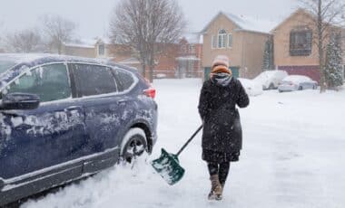
According to NOAA, El Niño generally brings warmer temperatures, though colder periods and snowfall can still occur. Other western states, including Nevada, Utah, Colorado, New Mexico and Arizona, could also see increased snowfall during the winter season.
Meteorologist Jeff Berardelli of WFLA-TV wrote that the developing event could produce unusual weather conditions, pointing to a stronger subtropical jet stream affecting the southern United States and Florida. NOAA is scheduled to release its next ENSO Diagnostics Discussion on 10 September, providing further updates on how the developing El Niño may influence winter weather across the country.