El Niño is a recurring climate pattern linked to warmer-than-average sea surface temperatures in the central and eastern Pacific. Its effects can influence rainfall, temperatures and tropical activity in different parts of the world, though the exact impacts vary by region.
A Growing Warm Water Tongue Across the Pacific
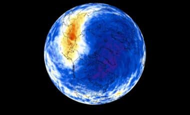
A live map from ElNinoLive shows the expansion of a warm, tongue-shaped band stretching along the equator from the coast of South America into the Pacific. The feature is one of the visible signs associated with El Niño conditions, as warm surface water moves eastward and replaces some of the cooler conditions normally maintained by Pacific trade winds.
According to ElNinoLive, the map data comes from NASA satellite observations and shows sea surface temperature differences compared with the long-term average for the time of year. On April 15, the warm areas appeared more scattered, while by May 27 a clearer band had developed from the South American coast. The feature became broader and more continuous by July 8, before showing a stronger signal on September 22.
The colors on the map represent temperature anomalies, with warmer-than-average areas shown in yellow to red and cooler areas represented by green to purple. The strongest red zones indicate surface temperatures around 2 to 3 degrees Celsius above normal, according to ElNinoLive.
Scientists use broader measurements than daily surface changes when evaluating El Niño strength. NOAA’s Climate Prediction Center uses longer-term indicators, including the Relative Oceanic Niño Index, to assess the development of the event and its potential influence.
Forecasts Point to a Very Strong El Niño Event
NOAA’s Climate Prediction Center reported on September 10 that El Niño had strengthened, with sea surface temperature anomalies exceeding +3.0 degrees Celsius in parts of the eastern equatorial Pacific. The agency said there was a greater than 90 percent chance of a very strong event during the Northern Hemisphere fall and winter of 2026–27.
According to the Climate Prediction Center, there is also a 75 percent chance during October–December 2026 that the event reaches historic strength, defined as exceeding previous El Niño events in the historical record beginning in 1950 using the three-month Relative Oceanic Niño Index.
The developing event has already prompted preparation measures in California. Governor Gavin Newsom declared a statewide state of emergency on September 21, directing state agencies to prepare resources for possible flooding, coastal impacts and severe storms linked to the El Niño period.
The proclamation ordered the California Department of Water Resources to prepare supplies such as sandbags, pumps and other flood-response materials. It also directed officials to coordinate with dam owners, local flood-control agencies and transportation authorities to identify vulnerable infrastructure.
According to NOAA, strong El Niño events can increase the likelihood of typical El Niño-related weather patterns, but they do not produce identical conditions everywhere. Forecasts indicate that impacts will become more widespread across the United States from December through March, when El Niño’s influence on seasonal weather patterns is usually stronger.