

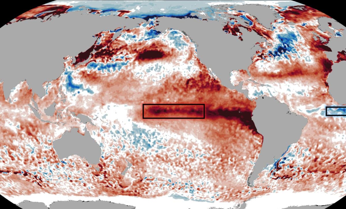
The pairing has drawn attention because it brings together opposite ocean temperature anomalies in different basins that can produce similar effects in the atmosphere. While the Pacific is experiencing warmer-than-average sea surface temperatures linked to El Niño, parts of the tropical Atlantic are developing colder-than-average waters associated with Atlantic Niña.
The interaction between these climate patterns is being closely monitored because it influences atmospheric circulation rather than ocean temperatures alone. According to NOAA and Severe Weather Europe, changes in wind patterns, air pressure, and moisture associated with these events can affect tropical cyclone formation across the Atlantic basin.
Atlantic Niña Emerges as an Uncommon Summer Event
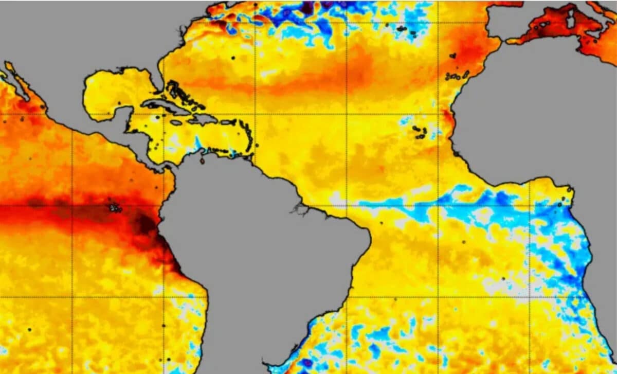
According to Severe Weather Europe, Atlantic Niña is now visible as a cold pool across the tropical Atlantic while warm El Niño anomalies continue to intensify across the Pacific. The meteorological platform reported that this combination favors higher atmospheric pressure, sinking air, stronger wind shear, and reduced rainfall across the main tropical development regions, creating what it described as an “atmospheric shield” for the U.S. hurricane season.
The Atlantic cooling is also notable because strong Atlantic Niña events during summer are relatively uncommon. Severe Weather Europe reported that if the current cooling persists and seasonal temperature anomalies fall below minus 0.5 degrees Celsius, 2026 would become only the sixth Atlantic Niña recorded in more than 40 years of historical observations.
The report also stated that sea surface temperatures in the Atlantic Niña region are currently around 1 to 3 degrees Celsius below normal. According to Severe Weather Europe, the cooling has been linked to strengthened trade-wind-driven upwelling, and forecast output cited by the platform indicates that the cool anomaly is expected to persist into late August while Pacific El Niño anomalies continue to strengthen.
Atmospheric Conditions Matter More Than Ocean Temperatures Alone
According to Severe Weather Europe, the primary influence on hurricane activity comes from atmospheric conditions rather than sea surface temperatures by themselves. El Niño typically makes the Atlantic less favorable for tropical cyclone development by increasing wind shear, promoting sinking air, and drying the middle levels of the atmosphere.
Even so, the report emphasized that reduced activity does not eliminate the possibility of destructive storms. Severe Weather Europe cited Hurricane Andrew in 1992 as an example of a catastrophic hurricane that occurred during an El Niño-suppressed Atlantic season.
Washington Post meteorologist and weather writer Ben Noll also commented on the developing Atlantic cooling on X, writing that “the cool waters from this climate driver could have a dampening effect on hurricane activity.”
🔴 Niño in the Pacific… Niña in the Atlantic?! 🔵
— Ben Noll (@BenNollWeather) July 15, 2026
El Niño's cousin, the Atlantic Niña, looks to be developing along the equator west of Africa.
The cool waters from this climate driver could have a dampening effect on hurricane activity. pic.twitter.com/6vi18Nw3Df
NOAA Explains Both Climate Patterns and Their Current Status
According to NOAA, Atlantic Niña is the cold phase of the Atlantic zonal mode, a naturally occurring climate pattern in the equatorial Atlantic that alternates between warm and cool phases every few years. It generally refers to colder-than-average sea surface temperatures in the eastern equatorial Atlantic, with many definitions requiring three-month average anomalies below minus 0.5 degrees Celsius for at least two overlapping seasons.
NOAA explains that the eastern equatorial Atlantic normally cools during July and August as southeasterly winds push surface waters away from the equator, allowing colder water from below to rise through upwelling.
NOAA also defines El Niño as the warm phase of the El Niño-Southern Oscillation (ENSO), a recurring Pacific climate pattern that changes ocean temperatures and alters tropical wind and rainfall patterns with impacts on weather around the world. In its July 9 update, NOAA’s Climate Prediction Center said El Niño is continuing and is expected to strengthen through the end of the year, with a 97 percent chance that it will persist into early spring 2027. The center also said there is an 81 percent chance that the October-to-December period will experience a very strong El Niño, potentially ranking among the largest events in records dating back to 1950.





I didn’t realize the Pacific and Atlantic patterns could interact like that. Makes me wonder how it will affect wedding planning in coastal areas.