The United Kingdom is set to experience freezing weather temperatures due to a rare stratospheric event. The Met Office has announced that Sudden Stratospheric Warming (SSW), a once-in-250-years weather anomaly which disrupts the normal westward flow of air in the stratosphere, is currently occurring over the UK.
What is a Sudden Stratospheric Warming Event? And How Could It Affect the UK?
Sudden Stratospheric Warming (SSW) disrupts the typical westerly flow of air in the stratosphere, leading to meandering of the jet stream and potentially the development of a blocking pattern. The stall patterns are associated with persistent areas of high pressure which disrupt the normal flow of weather systems, such as the low pressure systems which often affect the UK. Rather than the mild, wet and windy weather that these systems usually bring, blocking patterns can lead to cold, dry conditions as Atlantic storms are diverted.
SSW events occur regularly, about once every two years, but this winter saw an unprecedented three, according to Met Office records. Even though freezing is not always directly linked to SSWs, studies show that around 70% of SSWs are linked to cold temperatures. March 2018’s chaotic weather conditions, including heavy snowfall, icy conditions and high winds that led to loss of life and major societal disruption, were the result of an SSW event.
Fortunately, thanks to satellites, it is possible to track the progress of the sudden stratospheric warming, enabling us to prepare for them. In previous research conducted by the Met Office using computer models, it has been estimated that three high winds in one winter can occur approximately once every 250 years, so the current situation is not unexpected.
The Met Office’s head of long-range forecasting, Professor Adam Scaife, said that even though high wind events are common and occur about once every two years, this is the first time since records began that three high wind events have been observed this winter.
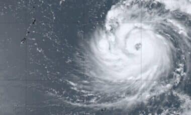
A Sudden Stratospheric Warming (SSW) event is underway – this chart shows temperatures rising rapidly here and Polar Vortex is collapsing. This will encourage blocking high pressure over Greenland and Iceland next few weeks. Intermittent cold N+W half EU. Often v. mild in SE EU. pic.twitter.com/5oHPAljxGJ
— wxcharts – a MetDesk Company (@wxcharts) March 5, 2024
Weather Conditions Expected Over the Next Two to Four Weeks
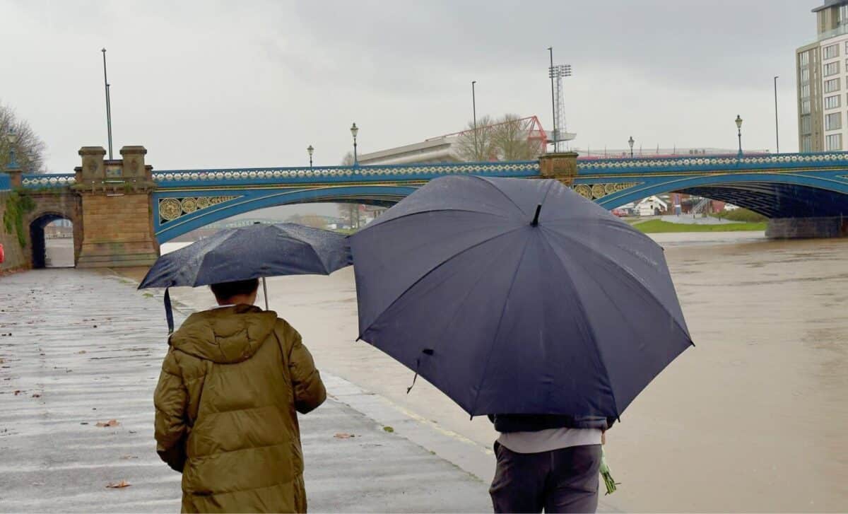
A 40-50% chance of below-average temperatures is expected across much of the UK over the next two to four weeks, according to the Met Office. Northern and eastern parts of the UK are particularly likely to experience colder weather over this period. An increased likelihood of below-normal temperatures is not a guarantee of freezing conditions, but it is a signal to prepare for a potentially cooler end to winter.
Nevertheless, some good news comes from the fact that the Met Office does not currently predict any weather events as severe as 2018’s ‘Beast from the East’ snowstorm, which brought the country to a standstill. The public should however remain alert to the Met Office’s warnings and take the necessary precautions if very cold and wintry weather develops over the next month.
Weather Forecast for the Next 5 Days: 8 March–12 March
This Evening and Overnight
Here, as we move into the evening, many areas will remain dry, despite occasional cloud cover, particularly in the north-east. However, expect the clouds to thicken from the south-west, as the rainy precipitation gradually progresses north-eastwards overnight. In the sheltered valleys of Scotland, there is a risk of frost, while the wind persists across the region.
Saturday
Conditions will remain unsettled on Saturday, with showers persisting and spreading north-eastwards throughout the day. The majority of areas will experience cloudy weather, although there may be occasional breaks giving way to clear spells. However, strong easterly winds will contribute to a cool atmosphere.
Prospects for Sunday to Tuesday
By the end of the weekend and early in the week, we can expect an increase in precipitation on Sunday, which will become more widespread.
There is, perhaps, a ray on the horizon for Monday, with drier conditions gradually settling in from the west, accompanied by a reduction in wind intensity.
On Tuesday, most people will enjoy a respite, with dry conditions, albeit briefly, before another spell of rain and cloud approaches from the west later in the day.