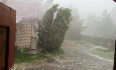

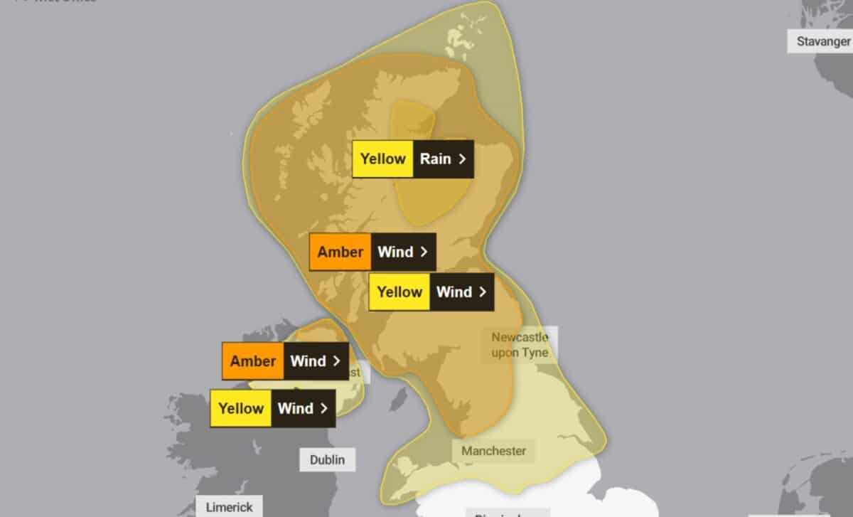
According to the Met Office, wind gusts could reach 80 mph or more in some exposed locations, particularly across Scotland and the far north of England. Heavy and persistent rainfall is also forecast for parts of Scotland, while other areas are expected to experience drier conditions. The warnings cover numerous regions, with potential disruption to transport, buildings and outdoor activities.
Strong Winds Threaten Widespread Disruption Across Northern Britain
The Met Office has warned that winds will remain strong throughout much of Sunday before gradually easing from the southwest later in the day. Gusts of 55–65 mph are expected widely, while coastal and exposed locations could experience speeds of 70–80 mph or more.
According to the Met Office, several weather warnings remained active on Sunday morning, including a yellow wind warning covering Staffordshire and Stoke-on-Trent. The strongest gusts are expected across Scotland and the far north of England, where conditions could remain particularly unsettled.
A yellow warning indicates possible injuries and danger to life from flying debris. Strong winds may also damage buildings and trees, while journeys by road, rail, air and ferry could take longer than usual. The geographical extent of the warnings is considerable. Areas affected include parts of the Scottish Highlands, Grampian, Strathclyde, central Scotland and the Borders, alongside large sections of northern England.
In England, the warning areas include Cumbria, Lancashire, Greater Manchester, Northumberland, Durham and parts of Yorkshire. Derbyshire, Nottinghamshire and Lincolnshire are also listed, along with several local authorities in north Wales.
The Met Office updated warning information on Saturday, 24 October, extending coverage farther south across northern England and into north Wales. Another update removed Northern Ireland from a warning area because of differing timings.
West Midlands Faces a Cold and Windy Start to the Week
In the West Midlands, forecasters expect the strongest winds to peak on Sunday morning, although blustery conditions will persist throughout the day. Some bright or sunny intervals are possible, with temperatures reaching 12°C.
Despite those brighter spells, the wind will make conditions feel cold. By Sunday evening, temperatures are expected to fall to 9°C, with strong winds and showers continuing across the region.
According to the forecast reported by the Birmingham Mail, Monday morning will feel unpleasant as winds strengthen beneath a band of rain. Patchy rainfall and brighter intervals are anticipated during the afternoon, accompanied by very strong winds.
The unsettled conditions follow a weekend in which Storm Boelo has brought widespread wind and rain to the UK. Forecasters have maintained alerts across numerous local authority areas, reflecting the broad geographical reach of the storm.
For Staffordshire and Stoke-on-Trent, Sunday’s yellow wind warning remains scheduled to run until 9pm. Elsewhere, heavy rain across parts of Scotland and strong winds in northern areas remain among the main concerns identified in the forecasts.