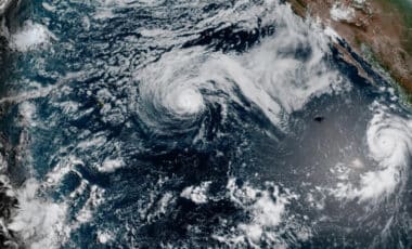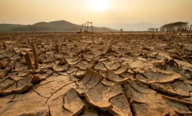

The developing event is drawing comparisons with the major El Niños of 1982–83, 1997–98 and 2015–16, all of which produced large shifts in weather patterns around the world. According to Newsweek, NOAA’s Climate Prediction Center expects the strongest effects to emerge during the colder half of the year, when El Niño typically has its clearest influence on weather across the United States.
Pacific Temperatures Point toward an Unusually Strong Event
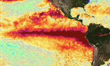
El Niño develops when sea surface temperatures become warmer than average across the central and eastern tropical Pacific. Those warmer waters alter rainfall, atmospheric pressure and large-scale circulation patterns, influencing weather far beyond the Pacific itself.
NOAA forecasters expect sea surface temperature anomalies in the monitored Niño region to exceed 2.5 degrees Celsius above average when measured over a three-month period. CNN reported that the agency’s updated forecast reflects both the rapid pace of the current warming and computer models that are nearly unanimous in showing the event peaking in late fall or early winter at a higher level than previously expected.
The agency has also adopted the Relative Oceanic Niño Index, or RONI, to account for the broader warming of tropical oceans over recent decades. Background ocean temperatures have risen as the climate has warmed, potentially reducing the apparent contrast between an El Niño event and surrounding waters. Even under that adjusted measure, NOAA expects the 2026–27 event to reach unprecedented intensity.
University of California climate scientist Daniel Swain described the developing conditions as “a genuinely remarkable event” during a YouTube briefing cited by CNN. “We’re already at record-breaking or record-tying territory now, and we’re expected to skyrocket,” he said.
A Stronger El Niño Raises Weather Risks but Does Not Guarantee Them
Past powerful El Niños provide some indication of the types of weather shifts that may occur, though forecasters stress that no two events behave identically. The 1982–83 and 1997–98 events were associated with heavy rainfall, flooding and landslides in California, while the 2015–16 episode produced severe drought in the Caribbean and Ethiopia and record hurricane activity in the central North Pacific.
In the United States, El Niño most consistently affects conditions from October through March. According to Newsweek, historical records show that most El Niño events bring above-average precipitation along the Gulf Coast from Texas to Florida. The strongest events have also carried the highest historical probability of drought-relieving rainfall in California and the Southwest.
A stronger southern branch of the jet stream may favor wetter conditions across much of the southern United States, while El Niño winters often bring milder and drier conditions to parts of the Midwest. El Niño can also reduce the frequency of named storms in the Atlantic Basin while increasing tropical cyclone activity in parts of the Pacific.
Forecasters caution that strength alone does not determine the outcome. Marine heat waves, Pacific-wide ocean temperatures and the polar vortex can alter the seasonal response. NOAA therefore describes typical El Niño impacts as more likely under a very strong event, rather than guaranteed, even if the 2026–27 cycle ultimately becomes the strongest recorded since 1950.