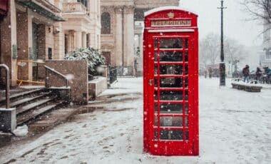
The developing El Niño has already exceeded previous records by some measures, raising questions about its influence on the coming winter. While wetter and stormier conditions are more likely during autumn, scientists are examining whether changes high above the Arctic could eventually allow colder air to reach Britain and Ireland.
How El Niño Could Weaken the Polar Vortex and Alter Britain’s Winter
El Niño develops when sea surface temperatures across the central and eastern tropical Pacific become significantly warmer than average. The resulting release of heat into the atmosphere influences circulation patterns around the world, although its effects vary considerably between regions.
According to the Met Office, the current El Niño has already exceeded previous records, with several weeks remaining before its expected peak later this year. Professor Adam Scaife, the agency’s head of long-range predictions, described the event as unprecedented, while acknowledging that scientists are still assessing whether its impacts will match its magnitude.
One possible consequence involves the polar vortex, a ring of strong westerly winds circulating approximately 10–30 miles (16–48km) above the Earth’s surface during winter. These winds develop as temperatures in the stratosphere above the North Pole fall sharply, creating a contrast with warmer air farther south.
When the vortex remains strong, it generally supports a powerful jet stream that carries Atlantic weather systems towards Britain, bringing relatively mild conditions alongside wind and rain.
A weakened or disrupted vortex can produce a different outcome. Changes in the stratosphere may gradually influence the jet stream below, allowing it to meander and potentially directing colder northerly or easterly winds towards the British Isles. This process can involve sudden stratospheric warming, an atmospheric event capable of disrupting the polar vortex and increasing the likelihood of prolonged cold spells.
Why Forecasters Say Widespread Snowfall Remains Uncertain
Despite the potential connection, scientists emphasise that a disrupted polar vortex does not automatically produce severe winter weather at ground level. According to BBC Weather presenter Ben Rich, disturbances high in the stratosphere do not always translate into changes in surface weather patterns. Equally, Britain can experience cold winters and an unusually meandering jet stream without significant disruption to the polar vortex.
Historical examples illustrate this uncertainty. The winter of 2009–2010, then Britain’s coldest in three decades, coincided with El Niño. Yet the winter of 2006–2007 also occurred during El Niño conditions and was unusually warm.
The Beast from the East in 2018, which brought substantial snowfall and freezing temperatures, followed sudden stratospheric warming but occurred during La Niña, the opposite phase of El Niño.
According to Met Éireann, El Niño’s influence on Ireland and Europe is comparatively weak, highly variable and not robust in the present-day climate. For now, the Met Office expects changeable autumn conditions, including Atlantic rain, showers and occasional strong winds, with temperatures generally above average.