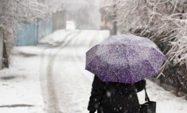

According to the Birmingham Mail, maps produced by WX Charts using the GFS forecasting model show areas of snow developing across northern Scotland between 12 and 14 October. The charts suggest that as many as 12 counties could experience at least a dusting, although the Met Office’s official long-range forecast focuses mainly on unsettled Atlantic weather rather than widespread snowfall.
Forecast Maps Point to Snow in Northern Scotland
WX Charts shows patches of snow spreading across northern Scotland during the middle of October, with the highest suggested accumulations reaching 4cm north of the border. The forecast would represent the first snow of the season in parts of the UK.
Autumn began on 1 September under the meteorological calendar, while the astronomical season started on 23 September 2026. The appearance of snow during October would therefore come relatively early in the season, though the forecasts provided do not indicate widespread disruption.
The broader Met Office outlook is more cautious about the detail. According to the Met Office forecast updated on 3 October, the period from 8 to 17 October is expected to become increasingly changeable as weather systems move in from the Atlantic.
These systems are forecast to bring spells of rain or showers to most parts of the country, with some heavy rain, especially in the northwest, as well as periods of strong winds. Drier intervals are also expected between weather systems.
Temperatures are likely to be near or slightly below normal at first before possibly becoming warmer later in the period. For the second half of October, the Met Office expects the unsettled Atlantic pattern to continue, with the wettest and windiest conditions most likely in the northwest.
El Niño Linked to Changes in the Polar Vortex
The snow forecasts come alongside discussion of how El Niño may influence conditions later in the season. A research paper from the US government’s NOAA Chemical Sciences Laboratory found that El Niño tends to encourage a breakdown of the polar vortex, particularly towards the end of winter.
According to a Met Office spokesperson cited by BirminghamMail, the stratospheric polar vortex can weaken during the latter part of winter after El Niño reaches its peak. This can raise the likelihood of Sudden Stratospheric Warming events, which in turn increase the potential for colder weather.
Met Office chief forecaster Dr Will Lang described the effect as a “subtle shift in the odds” rather than a certainty. He said there was a heightened potential for wet weather, stormy conditions and flooding. Grahame Madge, a Met Office climate spokesman, said the current El Niño event was still developing in the tropical Pacific and had already exceeded the magnitude of previous events including 2015/16.
He also noted established links between El Niño and UK autumn and winter weather, including a tendency towards a stormier start to the season and a greater chance of colder spells later in winter. For the immediate period, the Met Office forecast remains focused on rain, wind and a gradual fall in temperatures, while the WX Charts model indicates that some northern areas could also see the first snow of autumn.