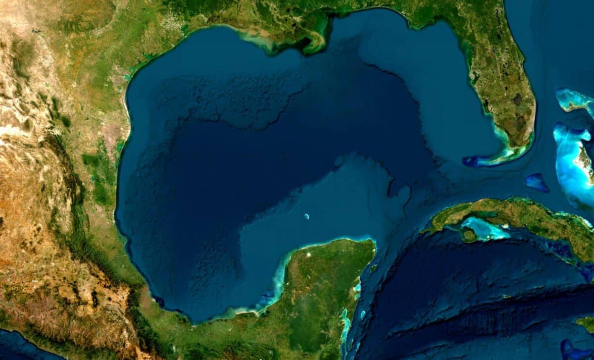
A weather disturbance in the Gulf of Mexico is drawing closer scrutiny after US forecasters increased the likelihood of tropical cyclone development. The system, known as Invest 90L, is expected to move northward near the Texas coast during the coming days.
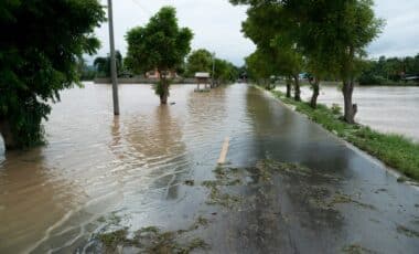
The updated outlook comes as meteorologists warn that heavy rainfall, flash flooding and coastal impacts could affect parts of Texas, Louisiana, Mississippi and Alabama, regardless of whether the disturbance develops into a named storm.
The National Hurricane Center (NHC) raised the system’s probability of tropical cyclone formation to 50 per cent on Monday, up from 30 per cent earlier in the day. According to the NHC, environmental conditions may become more favourable for development later this week as the disturbance moves across the north-western Gulf.
Forecasters have stressed that uncertainty remains regarding both the track and intensity of the system. Even so, preparations are already being discussed across areas vulnerable to flooding and severe rainfall.
Forecasters Track Invest 90L as Development Chances Increase
The disturbance, designated Invest 90L, is currently located near north-eastern Mexico. According to the National Hurricane Center, it is expected to drift north before moving along the Texas coastline and potentially emerging over the north-western Gulf by late Tuesday or Wednesday.
Computer forecast models indicate that the system could organise into a tropical depression and possibly become Arthur, the first named storm of the 2026 Atlantic hurricane season. A tropical depression is classified as a system with maximum sustained winds of 38mph or less, while a tropical storm has sustained winds ranging from 39mph to 73mph.
According to the NHC, the disturbance has a 40 per cent chance of development within the next 48 hours and a 50 per cent chance within the next seven days.
Further assessment is expected when a Hurricane Hunter aircraft departs Mississippi early on Wednesday morning. The aircraft will fly into the disturbance to gather direct observations of wind speeds, air pressure and temperature. Crews will deploy dropsondes, specialised instruments designed to collect atmospheric data as they descend through the system.
The information gathered during the mission will be transmitted to forecasters and incorporated into weather models to help determine the disturbance’s structure, strength and future development.
Heavy Rainfall Remains the Primary Concern across Gulf Coast States
Meteorologists have emphasised that significant rainfall is likely even if the system fails to reach tropical storm status. According to meteorologist James Spann, areas across southern and eastern Texas, as well as parts of Louisiana and Mississippi, should prepare for periods of intense rainfall capable of producing flash, urban and river flooding.
Spann also noted that the weather feature is expected to bring heavy rain to Alabama on Thursday and Friday, creating additional flooding potential. He added that gusty winds and coastal flooding could affect sections of the north-western Gulf Coast, with tropical storm watches or warnings potentially required.
The National Weather Service has warned that repeated rounds of showers and thunderstorms are expected over the region during the coming days. Forecasters identified south-east Texas and parts of Louisiana as facing the greatest flood risk, where flash flooding could become considerable in some locations.
In Louisiana and Mississippi, tropical moisture is forecast to support several rounds of thunderstorms through at least Thursday. According to the National Weather Service, widespread rainfall totals of three to six inches are possible, with locally higher amounts in some areas. Officials have urged residents to continue monitoring forecasts closely and to be ready to act should flash flood warnings be issued.