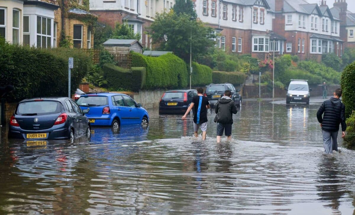
Well, get ready, ladies and gentlemen, this weekend is shaping up to be a very rainy weather in the UK. Unfortunately, you may not have planned to go out, as the forecast is calling for heavy rain and possible flooding in many areas.
Widespread Rain Expected Over the UK This Weekend
So, everyone knows what that means: boots, raincoats and umbrellas to hand! Here is an overview of the amount of rain expected, where flooding is most likely, and tips on how to prepare and stay safe during these two soaking wet days.
A wet and windy Saturday
Most of Britain is in for a cold shower on Saturday, according to the Met Office, with heavy rain and strong winds expected across the country.
Areas in the west and centre of the country are the worst affected by the rain, with some places receiving up to 40 mm in a few hours. This torrential rain, combined with already saturated ground, means that localised flooding is likely in the worst-hit areas.
Better weather on Sunday, but remain vigilant
There is likely to be a brief break in the rain on Sunday, thanks to the arrival of a ridge of high pressure which will bring drier, brighter weather to parts of Great Britain. However, the rain is not over yet – showers will persist in the south-east.
While the weather is improving, it is important to remain alert to difficult driving conditions and temporary flooding. Mild temperatures will continue throughout the weekend, with highs of up to 15°C thanks to warm air from the south-west.
Even though Sunday is the “better” of the two days, localised disturbances are still possible in the event of heavy showers. Take particular care if you’re travelling over the weekend, as spray and surface water can make roads treacherous.
Forecast for the coming week
Over the next week, the wet weather is set to continue for some time before temperatures start to fall back to values more typical for early February. The threat of strong winds is expected to diminish, providing some respite from a stormy weekend in Britain.
⚠️ Yellow weather warning updated ⚠️
Heavy rain across parts of England and Wales
Saturday 1500 – Sunday 0900
Latest info 👉 https://t.co/QwDLMfRBfs
Stay #WeatherAware⚠️ pic.twitter.com/dyOVRKoluh
— Met Office (@metoffice) February 17, 2024
Areas at Risk of Flooding Due to Heavy Rains
Many parts of the UK, particularly the western parts of England and Wales, are at high risk of temporary flooding of homes and businesses this weekend due to heavy rainfall of 40mm expected in 24 hours.
Severe weather warnings have been issued by the Met Office for most of England and Wales on Saturday and Sunday, indicating that rain is likely to cause disruption.
Travel is likely to be delayed, with slower journeys on roads and public transport. Electricity cuts are also possible if flooding affects infrastructure. Road users should exercise caution due to slippery roads and reduced visibility.
The south-west, Wales and central southern England appear to be most at risk of flooding according to forecasts. Residents in counties such as Devon, Cornwall, Somerset, Dorset and Gloucestershire should prepare for possible flooding. Tools such as sandbags, emergency supplies and evacuation plans can help mitigate damage in the event of rapidly rising waters.
Although rain will be heavy at times, temperatures are expected to remain mild for early March, hovering around 10 degrees Celsius. Warm air from the south feeds the wet weather system that crosses Britain. A few drier spells are possible, particularly on Sunday, but more rain is forecast for early next week.


