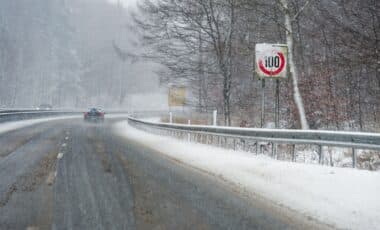
Forecasters warn of a significant weather event set to begin on 26 January, with severe snowfall and plummeting temperatures expected. Scotland could see accumulations of up to 60cm, with widespread impacts also forecast across England’s major cities.
A sharp drop in temperatures and substantial snowfall is forecast to affect large parts of the UK later this month. Beginning midday on Monday 26 January, this weather system is predicted to bring blizzard-like conditions and severe cold, affecting both Scotland and England.
Meteorological models show a large snow system sweeping across the country, with significant accumulations expected, especially in the north. According to WX Charts, the snowfall could disrupt transport networks, impact daily life and lead to potential weather warnings.
Snow Depth and Regional Variation
The most severe conditions are forecast for Scotland, where snowfall could reach depths of up to 60 centimetres. According to WX Charts, maps indicate that vast portions of the country will be heavily covered by snow towards the end of the month. Regions including Cumbria, Northumberland and County Durham are also expected to be affected, though with lesser accumulation.
In England, cities such as Birmingham, Greater London and Manchester are forecast to receive moderate snowfall. Specific estimates suggest Manchester could see around 5 centimetres, while the West Midlands (including Birmingham) may experience up to 3 centimetres. The North East of England, including Newcastle, could receive approximately 7 centimetres of snow.
These forecasts, based on data from Met Desk and visualised through WX Charts, indicate a widespread snow event likely to affect both urban centres and rural areas. The visualised weather maps have turned largely white, reflecting the extent of predicted snowfall and its geographical reach.
Temperature Forecasts and Blizzard Risk
Temperatures are also expected to drop significantly in tandem with the snowfall. According to WX Charts, Scotland may see temperatures fall to -7°C by midday on 26 January. Newcastle could record lows of -5°C, with Manchester forecast at -4°C. Birmingham and London are each predicted to experience -2°C conditions during the same period.
The combination of low temperatures and snow depth increases the likelihood of blizzard conditions, particularly in higher elevation regions. The WX Charts data describes this upcoming system as a “-7C weather blast,” and suggests that snow may be accompanied by strong winds in some areas.
Short-term forecasts from the Met Office also describe unsettled conditions in the days leading up to 26 January. A forecast for Wednesday 14 January notes a “bright but cold start” in most areas, followed by rain (potentially turning to snow) moving into northern parts of the country. For Thursday, it anticipates “a mix of sunshine and showers” in northern regions, with rain and increasing winds in the south.
According to the Met Office outlook for the weekend prior to the event, Friday could see “wind and rain clearing to the northeast,” followed by continued showery conditions into Saturday, which are expected to ease by Sunday. Temperatures during this period are expected to remain close to seasonal averages.
While no official weather warnings have yet been issued, the models suggest that significant disruption may be possible, particularly if predicted snow accumulations and low temperatures materialise as expected.


