
As February sets in, the UK braces for a significant weather event that will bring heavy snow and freezing temperatures across the country. According to weather forecasts, a large snowstorm is expected to affect 88 counties, ranging from the north of Scotland to the southern tip of England.
Widespread Snow Forecast for the UK
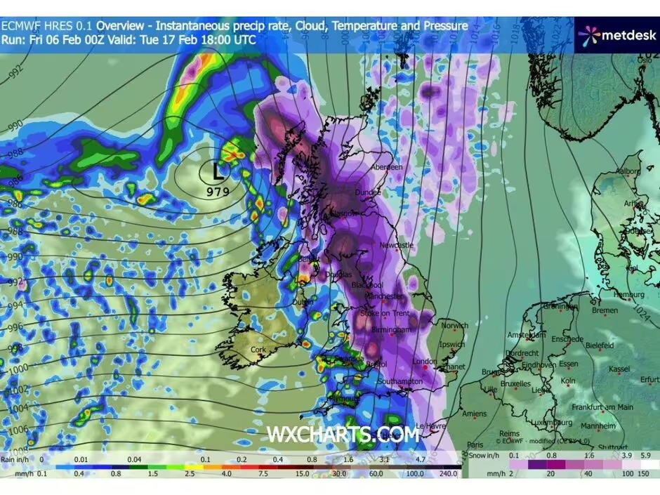
The UK is about to experience one of the most intense snowstorms in recent years. Forecasts predict heavy snowfall as far south as London and Kent, with certain regions expected to see up to 33cm of snow. The storm will move in from the Atlantic, initially hitting the western parts of the UK on February 17. By late afternoon, snow will extend across the entire country, from Southampton in the south to John O’Groats in the north of Scotland.
The weather models show significant snowfall in both urban and rural areas, with the heaviest accumulation expected in the northern counties, such as Cumbria and Northumberland. As temperatures plummet, the combination of snow and freezing conditions could create hazardous travel conditions, especially in higher altitudes and on the roads.
In London, temperatures are expected to drop to -5°C, while other parts of the UK, including Wales and Glasgow, will experience similarly cold weather. The cold front will not only cause snow but also dangerous driving conditions, with icy roads likely to persist throughout the day and into the night. In addition, the weather will impact various regions differently, with some areas experiencing more severe snowfalls than others.
Areas Most Affected by the Snowstorm
Accordint to Express, the snowstorm will have widespread effects across the UK, impacting counties in England, Scotland, Wales, and Northern Ireland. Some areas are predicted to face the heaviest snowfalls, while others will experience lighter dustings. The counties expected to experience the worst of the weather include:
England: Bedfordshire, Berkshire, Buckinghamshire, Cambridgeshire, Cheshire, Cumberland, Derbyshire, Durham, Essex, Gloucestershire, Hampshire, Herefordshire, Hertfordshire, Huntingdonshire, Kent, Lancashire, Leicestershire, Lincolnshire, Middlesex, Norfolk, Northamptonshire, Northumberland, Nottinghamshire, Oxfordshire, Rutland, Shropshire, Staffordshire, Suffolk, Surrey, Sussex, Warwickshire, Westmorland, Wiltshire, Worcestershire, Yorkshire.
Scotland: Aberdeenshire, Angus, Argyllshire, Ayrshire, Banffshire, Berwickshire, Bute, Caithness, Clackmannanshire, Cromartyshire, Dumfriesshire, Dunbartonshire, East Lothian, Fife, Inverness-shire, Kincardineshire, Kinross-shire, Kirkcudbrightshire, Lanarkshire, Midlothian, Morayshire, Nairnshire, Orkney, Peeblesshire, Perthshire, Renfrewshire, Ross-shire, Roxburghshire, Selkirkshire, Shetland, Stirlingshire, Sutherland, West Lothian, Wigtownshire.
Wales: Anglesey, Brecknockshire, Caernarfonshire, Cardiganshire, Carmarthenshire, Denbighshire, Flintshire, Glamorgan, Merionethshire, Monmouthshire, Montgomeryshire, Pembrokeshire, Radnorshire.
Northern Ireland: Antrim, Armagh, Down, Fermanagh, Londonderry/Derry, Tyrone.
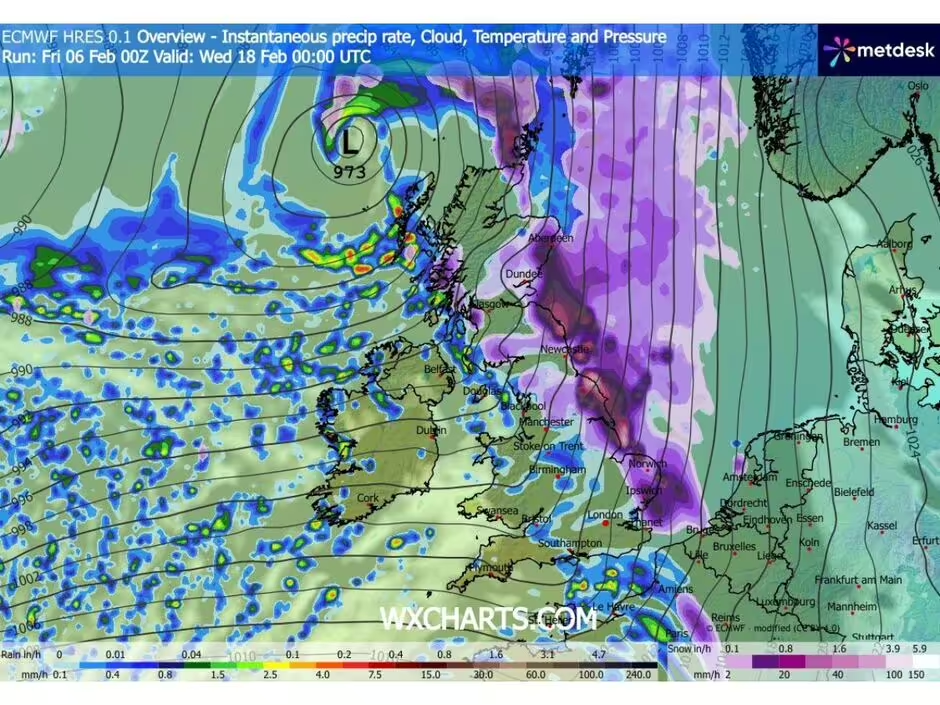
The snow is expected to fall heavily in these regions, with particular attention being paid to the northern counties, where up to 33cm of snow could accumulate. The south of the country, including Southampton, will also experience significant snowfalls, with predictions of up to 14cm in some areas. The snowstorm will move through the UK overnight, with conditions expected to improve slightly by February 20, 2026.
Impact on Travel and Daily Life
The snowstorm is set to cause major disruptions, particularly in areas where large amounts of snow are forecast. With temperatures dipping well below freezing, ice on the roads could make travel hazardous, especially in regions like Cumbria and Northumberland. The UK’s infrastructure, particularly in rural areas, may struggle to cope with the intensity of the storm.
Public transportation could also be severely affected, with train and bus services likely to be delayed or cancelled due to snow and icy conditions. Many local councils are preparing for the worst, ensuring that gritters are ready to tackle icy roads. However, given the scale of the snowstorm, there is concern that it may take time to clear the roads, leading to continued disruptions throughout the storm’s duration.
Schools in affected regions may also face closures, as heavy snowfalls could make it unsafe for students and staff to travel. Parents and students alike are being advised to stay informed through official channels for updates on school closures.
Longer-Term Weather Patterns and Flooding Risks
The snowstorm is not expected to be an isolated event. After the storm moves out of the UK by February 18, the country will continue to experience cold weather, with some areas facing the risk of flooding due to heavy rain and melting snow. According to the Met Office, while some regions will experience a slight respite from the snow by February 20, the overall unsettled weather pattern will continue, bringing further rain and snow showers.
The shift from cold to mild weather conditions is expected to lead to flooding, particularly in low-lying areas, as the snow begins to melt. This is a major concern for parts of northeast Britain, where heavier rainfall could exacerbate flooding risks. The Met Office has warned that the transition between cold and mild air masses could create challenges for flood management, especially in regions already vulnerable to wet conditions.


