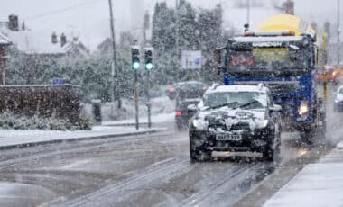
This dramatic shift in conditions marks a major change for the festive season. According to meteorologists, warm winds from the Atlantic will push temperatures into the double digits across much of the country, leaving Britons reaching for T-shirts instead of scarves and gloves. While some parts of the UK, especially in the north, may hang on to cooler temperatures for a while, snow looks set to remain a distant memory, and rain is now a far more likely holiday forecast.
A Sudden U-Turn in Weather Patterns
The dramatic change in weather is primarily attributed to a shift in wind patterns. Jim Dale, meteorologist for British Weather Services, explained that the shift from northerly winds to westerly winds would bring milder air into the UK.
This transition will bring a period of high pressure early in the week, providing a brief settled spell. However, according to the Met Office, a transition to lower pressure towards the end of the week will usher in wetter and windier conditions as Atlantic weather systems take over. Rain is expected to become more frequent in the run-up to Christmas, and with the weather becoming more changeable, there’s little chance of a return to the cold snap that recently gripped the UK.
The prospect of snow is rapidly diminishing, with the best chance now confined to the far north. Scotland and northern England may still experience some residual cold temperatures, but these are not expected to be sufficient for snowfall. As the warm air from the south settles in, those hoping for a traditional winter wonderland will likely be disappointed.
Christmas Rain, Not Snow
The most likely weather scenario for Christmas this year is a wet one, with a greater chance of rain rather than snow. This shift is a significant departure from the usual expectations of a crisp, snowy December. With the south-westerly winds bringing warmer air, areas across southern England could experience temperatures as high as 15°C in early December, a notable contrast to the freezing conditions of last week.
According to Met Office meteorologist Annie Shuttleworth, low-pressure systems arriving from the east are likely to become more persistent, further contributing to the wet and windy conditions. “After Tuesday, we are expecting a transition to low pressure, and low pressure will bring in milder, wetter and potentially windier weather at the end of the week.” she said.
However, despite the rain, the possibility of snow does still exist in very northern areas of the country, albeit faintly. The odds of a White Christmas now hinge largely on the vagaries of low-pressure systems, which may bring brief periods of colder air to the north but not enough to produce widespread snowfall.


