Tropical Storm Erin, which officially formed on August 12 near the Cabo Verde Islands, is currently tracking westward across the Atlantic Ocean. Meteorological agencies are monitoring its gradual intensification and evaluating a range of forecast models to determine its likely path and potential development into a hurricane. Midway through the week, models remain divided, with no definitive consensus on long-term impacts.
According to the Daily Record, while some independent forecasters have suggested a northeastward curve that could bring Storm Erin closer to the UK, most projections keep it over open waters. At this stage, there is little confirmed about Storm Erin’s final trajectory.
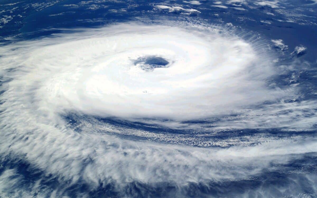
Storm Erin Hits Cabo Verde With Deadly Floods
Storm Erin has already caused serious flooding and destruction in parts of Cabo Verde, particularly on the islands of São Vicente and Santo Antão. Streets have been flooded and vehicles submerged after intense rainfall. Independent meteorologist Max Velocity reported on social media platform X that seven people have died due to the storm. This figure has not yet been confirmed by authorities.
The storm remains positioned just west of the island group and is forecast to strengthen gradually throughout the week.
Hurricane Development Expected Over Open Waters
Forecast models continue to show that Storm Erin may evolve into a major hurricane in the central Atlantic. A majority of spaghetti model projections suggest a northwesterly turn, which would keep the system well away from land. A smaller group of model tracks hint at a possible approach toward the Lesser Antilles later this week.
Despite a handful of independent forecasts, including Netweather, suggesting that Storm Erin could recurve northeast toward the UK “just in time for the weekend”, this remains a minority view. The Met Office has not issued any storm alerts related to Erin.
Storm Floris and Storm Dexter Affect UK Forecasts
The growing attention around Storm Erin follows recent severe weather in the UK. On Monday, August 4, Storm Floris brought high winds and widespread power outages to parts of Scotland. The UK had been placed under an Amber wind warning, particularly in northern regions.
Meanwhile, Storm Dexter is expected to influence short-term UK conditions in the coming days, especially in the south. This system is separate from Storm Erin but contributes to ongoing variability in regional weather models.
Met Office Outlook Remains Calm Despite Erin
As of now, the Met Office forecasts no direct threat from Storm Erin and continues to project stable weather conditions. The agency’s long-range forecast for Saturday, August 16 to Monday, August 25 states:
High pressure is set to dominate the UK by this weekend, bringing fine, dry, and very warm or hot weather with light winds for most, though breezier in the far south.
After a spell of cooler, cloudy, and murky conditions in the north, especially along coasts, it will turn clearer and warmer here too.
Early next week, there’s an increased chance of very hot conditions in the south, possibly with rain or thundery showers.
Once this clears, changeable weather is more likely, with outbreaks of rain (most frequent in the west) and warm, dry interludes with sunny spells.
Toward the end of this period, there are some indications of an increased chance of more generally unsettled weather developing, though confidence at this range is typically low.
Although Storm Erin will remain under close observation, there is no current indication that it will shift course dramatically enough to reach UK shores in the coming week.
With the Atlantic hurricane season entering its peak, Storm Erin is a reminder of how quickly systems can develop. But at this stage, the balance of evidence suggests the storm will remain over the ocean and not threaten the UK directly.


