The UK is bracing for a significant weather event, with the Met Office issuing snow and ice warnings for several regions. The alerts, which affect both Scotland and parts of England, warn of travel disruptions, icy conditions, and the potential for snow accumulations over the coming days.
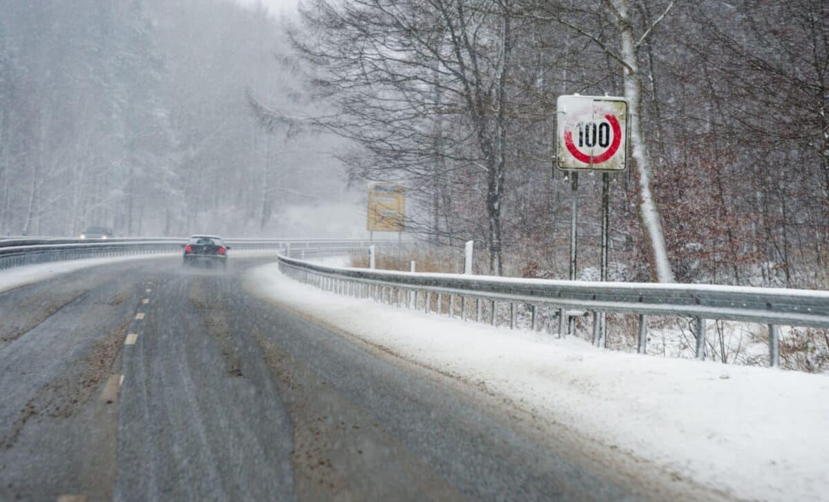
From late Thursday, February 12, into the early hours of Friday, February 13, the UK will see wintry weather, particularly in the north and on high ground. Snow showers, combined with rapidly dropping temperatures, could make road conditions hazardous. According to the Met Office, the snow could lead to significant disruption to travel, especially for those attempting to commute or travel overnight.
Snow and Ice Alerts for Multiple Regions
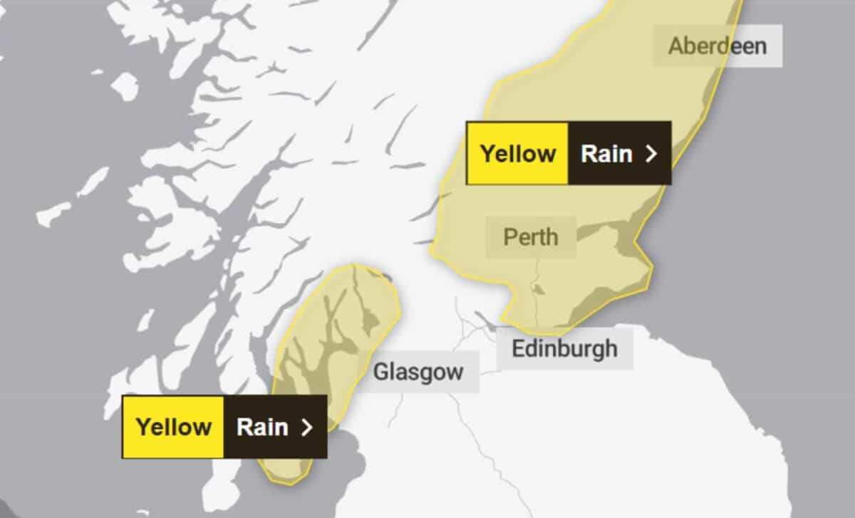
The Met Office has issued a 17-hour snow and ice warning for Thursday and Friday, which will impact both England and Scotland. The warning is set to begin at 4 pm on Thursday, February 12, and last until midday on Friday, February 13. According to the Met Office, snow showers are expected to develop, with higher areas likely to experience the heaviest accumulations. While some areas in England may see snow as low as 1-2 cm, regions in Scotland are likely to experience snow accumulations of 2-5 cm, particularly on high ground.
The heavy snow combined with icy conditions on untreated roads could lead to delays in transport. The warning highlights that roads, railways, and bus services may be disrupted, with longer journey times and a higher risk of accidents due to slippery surfaces. Drivers are being urged to allow extra time for travel and check their routes for possible closures or delays.
Key Areas Affected by Snow and Ice
In total, the Met Office has named 32 areas in the UK at risk of snow and ice, with the snow expected to start falling on Thursday evening and continue overnight. According to the Met Office’s alert, the affected areas are:
- Angus
- Clackmannanshire
- Dundee
- Falkirk
- Fife
- Perth and Kinross
- Stirling
- Aberdeen
- Aberdeenshire
- Moray
- Na h-Eileanan Siar
- Highland
- Orkney Islands
- Shetland Islands
- Dumfries and Galloway
- East Lothian
- Edinburgh
- Midlothian Council
- Scottish Borders
- West Lothian
- Argyll and Bute
- East Ayrshire
- East Dunbartonshire
- East Renfrewshire
- Glasgow
- Inverclyde
- North Ayrshire
- North Lanarkshire
- Renfrewshire
- South Ayrshire
- South Lanarkshire
- West Dunbartonshire
The snow, while unlikely to cause major disruptions in most locations, could still lead to travel difficulties. Experts are advising commuters to take extra precautions, particularly when walking or cycling, as pavements and cycle paths are likely to become slippery. The snow is expected to move southward, with areas that are not normally affected by snow possibly seeing brief periods of wintery weather, with some of the heavier snowfalls occurring in more elevated areas.
The weather warnings serve as a reminder of the unpredictable nature of winter weather in the UK. With more snow and ice expected to hit the country over the coming days, the Met Office urges the public to stay updated with forecasts and take safety precautions during this cold snap.


