Persistent wet weather is set to return to parts of southern England, just days after Storm Goretti left a trail of damage across the country. The Met Office has issued a yellow weather warning for rain, citing the risk of surface water flooding and travel disruption.
The alert follows a week of severe conditions, including heavy snowfall, hurricane-force winds, and a rare red warning for the South West during Goretti’s peak. Forecasters are now urging residents in affected areas to remain alert, as already saturated ground may exacerbate the impact of Thursday’s rain.
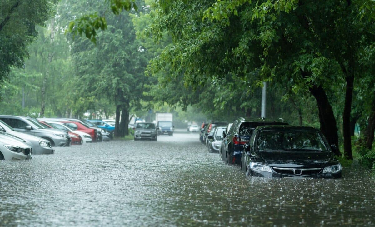
Rainfall Warning Follows Storm Goretti’s Heavy Toll
The Met Office warning, which covers London, South East England and South West England, forecasts up to 30mm of rain in just a few hours, with isolated spots potentially seeing up to 50mm, according to Met Office spokesperson Stephen Dixon. The rainfall is expected to arrive throughout Thursday, as a low-pressure system moves in from the south.
“This is falling on saturated ground for many,” Dixon explained, “which increases the sensitivity for rainfall amounts of this nature.” The warning highlights possible flooding of homes and businesses, as well as disruption to transport services, particularly for buses and trains.
Last week’s extreme conditions have already left the region vulnerable. Parts of the South West were battered by gusts approaching 100mph, and some areas recorded up to 30cm of snow. These events led to widespread power outages, blocked roads, and delays to public transport. With ground conditions still far from normal, even moderate rainfall could lead to rapid flooding in low-lying or poorly drained areas.
The Met Office has urged people in warning zones to check their flood risk, prepare emergency kits if needed, and avoid unnecessary travel during peak rainfall hours. Motorists are advised to consult local road updates and take caution due to the likelihood of standing water and reduced visibility.
Unsettled Weather Pattern Expected to Continue Into Weekend
The renewed warning adds to what has already been an unstable period of weather across the UK. According to the Met Office’s five-day forecast, the system bringing Thursday’s rain will also generate strong gusty winds in the South East. While northern regions may see a mix of sunshine and showers, the south will remain unsettled into early Friday.
By the weekend, conditions are expected to improve modestly. Winds and rain are likely to clear northeastwards on Friday, followed by brighter intervals and intermittent showers. Saturday may still bring further rainfall, particularly in coastal areas, but Sunday should see more isolated showers with average seasonal temperatures.
While this latest warning does not rise to the severity of last week’s red alert, the combination of waterlogged soil and repeated storms is testing the resilience of local infrastructure. Drainage systems in urban areas remain under pressure, and emergency services continue to monitor regions most at risk.
Storm Goretti’s impact has underscored the increasing volatility of winter weather in the UK. With more rain now expected over vulnerable ground, forecasters are cautioning against complacency, even in the absence of extreme warnings. Weather updates and flood alerts are available on the Met Office website and through local authorities.


