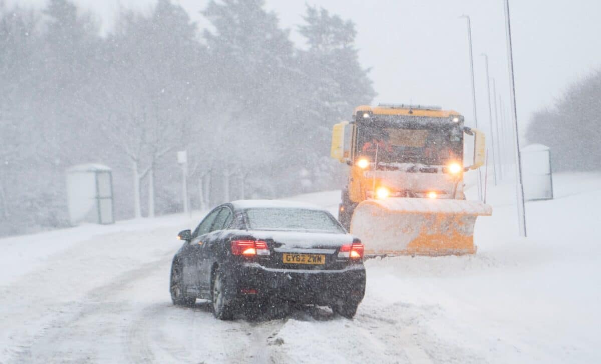
Snow, rain, and strong winds are set to affect large parts of the UK as the Met Office warns of unsettled weather conditions through the first week of February. The forecasters predict significant snowfall, particularly in the north, with colder temperatures likely to impact travel and daily life.
As Thursday, February 5, begins across the country, the Met Office has highlighted a range of weather hazards, including heavy rain, snow, and strong winds. This unsettled weather is expected to continue until the weekend, with the potential for further snow across the UK, especially in higher regions. According to the latest reports, snow warnings are in place for various areas, impacting everything from everyday commuting to local infrastructure.
Weather Conditions to Affect Northern and Southern Areas
On Thursday, February 5, the UK will experience mostly cloudy skies, with rain moving northward through the day. According to the Met Office, southern and southwestern England, as well as south Wales, will be particularly affected by heavy downpours. At the same time, northern areas of the UK, particularly the hills and mountainous regions, are expected to experience snow and cold winds. These conditions will make travel challenging, with snow on higher ground in the north and a risk of icy surfaces in rural areas.
By Friday, February 6, the weather is expected to worsen, with widespread rain and snow forecast for the northern half of the UK. According to the Met Office, the worst-hit regions will be those in northern Scotland, where heavy snow may accumulate. Snow will also affect parts of northern England, particularly in the Pennines and on the higher ground of the Lake District.
The Met Office has named several areas, including Manchester, Sheffield, and Edinburgh, that are likely to see snow on Friday, though it will mostly affect hilltops. Strong winds are expected to make conditions feel even colder, and some disruption to transport and infrastructure is anticipated in affected areas.
A Weekend of Unsettled Weather
Looking ahead to the weekend, the Met Office forecasts more unsettled conditions, with snow and rain continuing to impact the UK. On Saturday, February 7, patchy rain is expected across the southern parts of England, though conditions should improve as the day progresses. Meanwhile, further north, rain will persist in northeastern Scotland. Sunday, February 8, will be somewhat drier and milder, with rain clearing northwards, leaving behind variable cloud and a few showers.
However, snow and ice could still pose problems in the northern regions, particularly on higher ground, as cold temperatures persist. The Met Office also warns that strong winds will continue throughout the weekend, with coastal areas most likely to experience the worst conditions. These unsettled weather patterns, along with the possibility of flooding, are expected to affect much of the UK until early next week.
According to the Met Office, next week, from Monday, February 9 onwards, will see rainfall increase in the western parts of the UK, with the risk of flooding in some areas. Northern England and Scotland may see snow again, particularly in higher altitudes, although temperatures are expected to remain close to normal overall.


