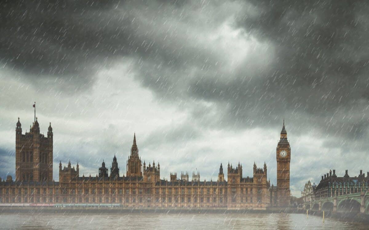
The UK is currently experiencing a Bank Holiday marked by sunny skies and warm temperatures, with many regions seeing highs of up to 29°C. The Met Office has issued weather warnings for the coming days as the pleasant conditions will be short-lived. According to a recent report from Mirror, while many parts of the country are enjoying the sunshine, some areas are already seeing light rain, which will intensify in the coming days.
By Wednesday, widespread heavy rain, thunderstorms, and even hail are expected. This article provides a detailed look at the upcoming weather changes and forecasts, ensuring you stay prepared.
Bank Holiday Scorcher: A Warm Start to the Week
For many Brits, today promises to be a sun-filled day with temperatures hitting highs of 29°C. This is well above the average temperature for late August, making the UK warmer than typical holiday destinations like the Canary Islands or even Barcelona, where temperatures are expected to peak at 27°C. The warm temperatures are a rare treat during the Bank Holiday, making it a perfect opportunity for outdoor activities.

However, while the warmth is welcomed, not all areas will experience uninterrupted sunshine. Western parts of the UK, particularly Northern Ireland, will start seeing some rain in the afternoon. The rain will gradually spread eastwards during the evening, bringing showers to western coastal areas as well. Though the majority of the country will bask in the sunshine, scattered rain will dampen the day for those in the affected regions.
What to Expect Tomorrow: Scattered Showers and a Cooler Day
Looking ahead to tomorrow, the weather takes a slight turn. The forecast predicts a mix of sunny spells and scattered showers. These showers are expected to be most frequent in the northwest, and some could be heavy with a chance of thunder. The Met Office has stated that conditions tomorrow will be “rather breezy,” with a band of rain moving eastwards through the evening and overnight.
This front will bring blustery showers, especially in the west, with some areas facing significant rainfall.
The Met Office also indicated that eastern parts of the country can still expect a warmer night compared to the cooler regions. Despite the cooler weather, the sunshine will still make it feel warm in many parts of the UK, especially for those enjoying the Bank Holiday.
Stormy Weather on the Horizon: A Week of Heavy Rain and Thunderstorms
The real shift in weather arrives on Wednesday. The UK is set to experience frequent showers, which will be heavy at times. These will come with the added threat of hail and thunder, particularly in the west of England, Scotland, and Wales. According to the Met Office, weather models show a huge band of rain engulfing the west coast, with up to 3-5mm of rain per hour falling at midday on Wednesday.
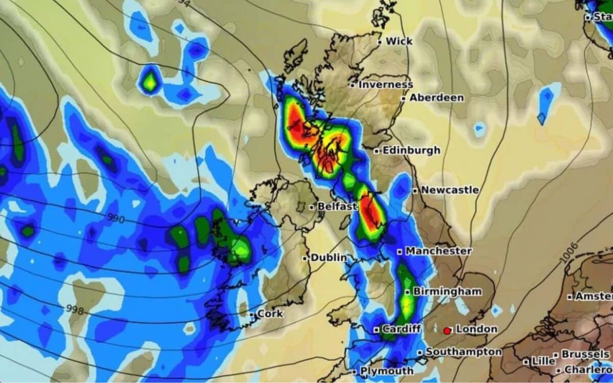
A large band of rain will extend across the western coasts, with showers expected to affect the country through Thursday and Friday. The weather will be significantly cooler, and the overall feel will be much wetter. Meteorologists also noted that the remnants of Hurricane Erin, currently affecting the eastern US, could influence the stormy weather in the UK this week, bringing stronger conditions to our shores.
How to Prepare for the Change in Weather
If you’re planning any outdoor activities this week, make sure to check local forecasts regularly, as the UK is transitioning from summer warmth to autumn-like conditions. With rainstorms, hail, and thunder expected by midweek, it’s advisable to keep an umbrella or raincoat handy. Despite the cooler weather, the sunny periods will still offer chances for outdoor enjoyment.
The Met Office said:
Today it will be warm or very warm for many, with plenty of sunshine. Cloud increasing in the far west during the day, with rain arriving across Northern Ireland late afternoon and western fringes of the rest of the UK by evening. Rather breezy.
Tonight, a band of rain, heavy at times, will move eastwards through the evening and overnight. Scattered blustery showers following, most frequent in the west. A warm night in the east. Tomorrow will be a day of sunny spells and scattered showers. Showers most frequent in the northwest, some heavy with the risk of thunder. Generally cooler, but still feeling warm in the sunshine.
The outlook from Wednesday to Friday looks even worse, as the national forecaster predicts “frequent showers”, which are “heavy at times, with hail and thunder.”
It is going to get warmer, generally getting sunnier as well, so by the time we get to Monday, I think we will see more blue skies generally – said Alex Deakin, meteorologist with the Met Office.