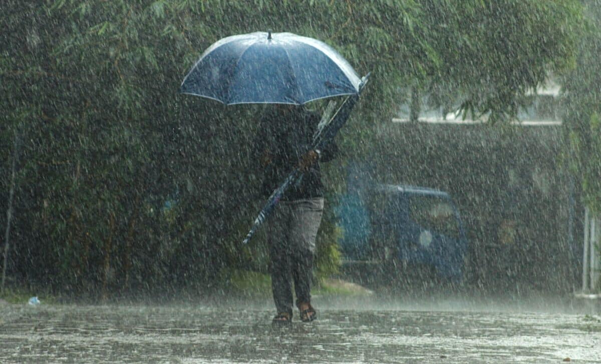
The UK is preparing for another spell of unsettled weather, as the Met Office predicts a mix of snow, rain, and gales across the country over the coming weeks. From Tuesday, February 24 to March 5, the forecast points to “broadly changeable” conditions, with Atlantic weather systems moving in, bringing frequent spells of wet and windy weather, particularly in the west. The east, however, may experience more sheltered conditions, with lighter rain and drier intervals. The forecast also warns of colder temperatures and a chance of snow in upland areas, especially as February draws to a close.
Changeable Conditions Expected Across the UK
According to Express, the UK will continue to experience a period of changeable weather through the end of February. The weather will be influenced by multiple Atlantic frontal systems moving across the country, which will bring heavy rain and showers, particularly to the west. The east, being more sheltered, is expected to see much smaller amounts of rain, but windy conditions will still affect much of the country. The forecast says, “Rain and showers typically heaviest and most frequent in the west, with more sheltered eastern areas seeing much smaller amounts of rain.”
In addition to the rain, the UK is likely to experience strong winds and possibly even gales. “Often windy with a chance of gales at times,” the Met Office warned, indicating that the weather could become particularly disruptive in some regions. Although temperatures are currently above average for this time of year, they are expected to fall closer to average by the end of February and into early March. The drop in temperature could bring cold enough conditions for wintry showers, particularly in the higher ground of the north, where snow is a possibility.
Snow Likely in Northern Uplands and Cold Weather to Return
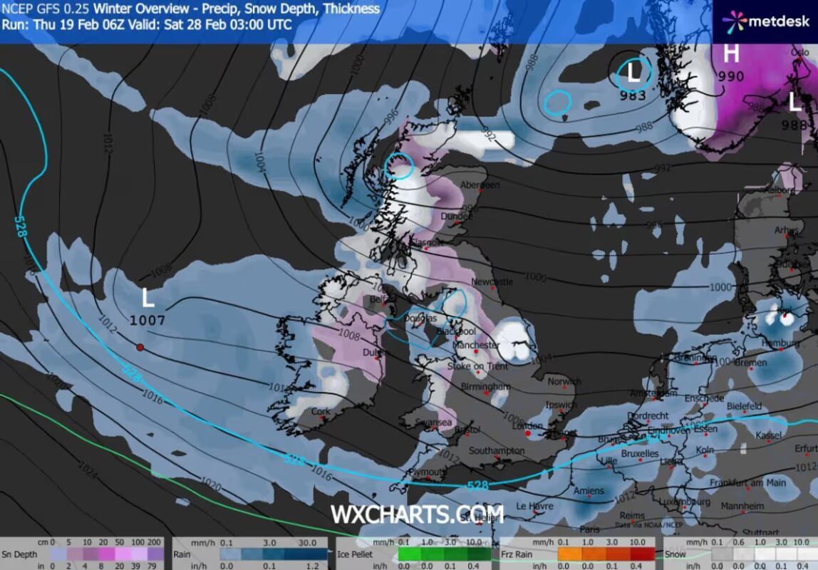
As the UK heads into March, colder conditions will likely affect northern and upland areas, particularly in the north of England and Scotland. Snow is expected to make a return in these regions as temperatures drop and colder air moves in. “Temperatures well above average at first, likely falling closer to average towards the end of February and into March, perhaps briefly cold enough for some wintry showers or even snow in upland areas of the north,” the Met Office stated.
The forecast is somewhat uncertain, but it is clear that the UK will continue to see fluctuating weather throughout the next month. While the northern uplands are expected to see snow, other areas, particularly in the south and east, may only experience lighter, more sporadic wintry showers. However, the potential for snow and sleet remains a concern for those living in higher altitudes, especially in the coming weeks as temperatures dip.
Low Confidence for March 6 to March 20: Wet and Windy Conditions Expected
Looking ahead to March, the Met Office’s forecast for the period from March 6 to March 20 suggests continued unsettled weather. Confidence in the exact details is low, but meteorologists expect the UK to continue experiencing changeable conditions, with low pressure systems influencing the weather. These systems will likely bring wet and windy spells, especially in the north and west of the country, where the weather tends to be more extreme.
“Confidence remains low through this period,” the Met Office noted, adding that the most likely scenario is a continuation of these changeable conditions. High-pressure systems may build across the UK from time to time, bringing some drier and quieter spells, but these will likely be short-lived and concentrated in the south and east.
“High pressure to the south may build across the UK at times to bring some drier, quieter interludes, this probably most frequent in the south and east – the chances of prolonged settled weather look very low,” the forecast explains.
The temperatures in March are expected to hover around or slightly above average, but cold snaps are possible, especially when low-pressure systems bring colder air into the country. The Met Office notes,
“Temperatures are likely to be near or slightly above average for the period as a whole, though some relatively short-lived interludes of colder conditions remain possible.”
Potential for Gales and More Snow Later in March
As March progresses, the likelihood of snow may decrease, but windy and wet weather is expected to continue. In particular, areas in the north and west could see more significant rainfall and stronger winds. “Occasional spells of wet and windy weather, especially in the north and west,” the forecast warns. Meanwhile, southern and eastern areas may experience periods of calmer weather, though these will be brief.
For the majority of the country, the return of wintry conditions seems unlikely to last long. However, the unpredictability of the weather means that these changeable periods could have significant impacts, particularly on travel and daily activities. With March expected to be marked by a continuing series of low-pressure systems, the UK is in for a potentially stormy and unsettled month.