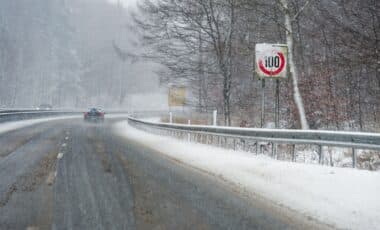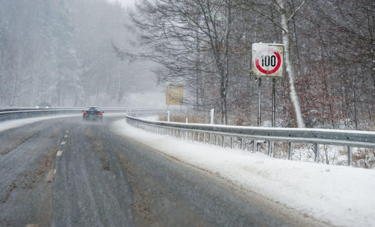
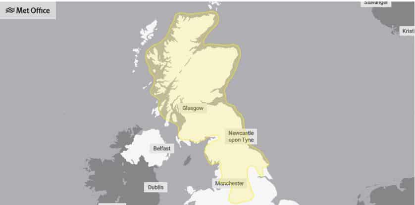
The UK is set to experience a bitterly cold weekend, as heavy snow and icy conditions sweep across large parts of the country. With 56 areas now under weather warnings, the Met Office has issued several alerts, cautioning residents of impending severe winter weather. The warnings are in place from Saturday night through Sunday morning, with snow expected to spread from northern England to Scotland, gradually moving southwards. In some regions, residents can expect snow accumulation up to 15 cm, while ice remains a significant hazard, particularly in higher ground areas.
Snow Predicted to Hit Northern England and Scotland First
According to the Met Office, snow is expected to fall across northern England and Scotland before gradually spreading south. Chief Forecaster Rebekah Hicks stated:
“Snow is likely ahead of the rain across northern England and Scotland and could reach lower levels at times Saturday night into Sunday. The snow will gradually turn to rain as the front moves east across the country on Sunday.”
The unpredictable nature of the weather means that some areas may witness significant snowfall, especially on higher ground.
The warning highlights the potential for snow to accumulate temporarily, with low-lying areas seeing between 1-3 cm of snow. Those living in higher elevations, such as the Scottish Highlands, may face heavier snowfall, with up to 15 cm expected above 400 metres. These weather events are expected to lead to treacherous travel conditions, particularly on Sunday morning, when a mixture of snow, rain, and possible freezing rain will affect the roads.
Ice Poses Major Risk in Northeast England and Scotland
While snow is the primary concern, ice is also a significant risk, especially in parts of northeast England and Scotland. The Met Office noted that
“Ice will be an additional hazard, particularly across northeast England and parts of Scotland where precipitation has the potential to fall on frozen ground leading to very slippery conditions.”
Drivers and pedestrians alike are urged to remain cautious as the icy conditions could lead to accidents, particularly in more rural or high-altitude regions where snow may linger for longer periods.
In these areas, temporary snow accumulations are expected to be manageable at lower altitudes. However, the combination of ice and snow will result in a hazardous mix of wet, slippery surfaces, potentially causing disruptions to both road and rail travel.
Coastal Areas Bracing for Strong Winds and Heavy Rain
In addition to the snow and ice, coastal areas along the UK will also experience strong winds, particularly on Sunday. As the weather front moves east, rain is expected to follow the snow, sometimes turning heavy. “The rain may be heavy at times, and it will be windy in coastal areas. Additional warnings may be required. We encourage the public to keep up to date with the latest forecasts and any warnings that may be issued,” the Met Office warned. These conditions could create dangerous sea states, particularly along the eastern coastlines, where gusts are likely to cause disruption to marine and coastal activities.
Affected Areas Across the UK
The regions affected by the Met Office’s weather warnings for snow and ice span much of the UK, with several areas facing some of the harshest conditions this weekend. In Scotland, Central, Tayside & Fife is particularly vulnerable, including areas such as Angus, Clackmannanshire, Dundee, Falkirk, Fife, Perth and Kinross, and Stirling. These areas are expected to experience significant snowfall, especially on higher ground, and ice is a major concern.
Further south, East Midlands regions like Derby, Derbyshire, Nottingham, and Nottinghamshire are bracing for snow and icy conditions that could lead to dangerous driving. The cold front will move into North East England, affecting areas such as Darlington, Durham, Gateshead, Hartlepool, Middlesbrough, Newcastle upon Tyne, North Tyneside, Northumberland, Redcar and Cleveland, South Tyneside, Stockton-on-Tees, and Sunderland. These areas will see snow and ice, with a risk of disruption to transport networks.
In the North West, Blackburn with Darwen, Cheshire East, Cumbria, Greater Manchester, and Lancashire are under the weather warnings, along with other regions in SW Scotland, such as Dumfries and Galloway, East Lothian, Edinburgh, Midlothian Council, Scottish Borders, and West Lothian. Parts of Strathclyde including Argyll and Bute, East Ayrshire, East Dunbartonshire, East Renfrewshire, Glasgow, Inverclyde, North Ayrshire, North Lanarkshire, Renfrewshire, South Ayrshire, South Lanarkshire, West Dunbartonshire will also see challenging winter conditions.
Lastly, West Midlands areas, including Staffordshire and Stoke-on-Trent, are included in the snow warnings, as well as parts of Yorkshire & Humber, including East Riding of Yorkshire, North Yorkshire, South Yorkshire, and West Yorkshire. These areas are all at risk of snow, ice, and hazardous road conditions due to the incoming weather front.
Snow Expected to Clear with a Gradual Thaw on Sunday
As the weather front continues its march eastward, the snow is expected to turn to rain in many areas, with a thaw beginning by Sunday afternoon. However, conditions will remain cold, and residents are advised to stay updated on any additional warnings as the weather system develops.
“The snow will turn increasingly to rain into Sunday morning, perhaps as a short spell of freezing rain in places, before eventually clearing to the east with a steady thaw of lying snow then setting in,” the Met Office explained. These thawing conditions could result in more flooding in areas already affected by heavy precipitation, so caution is advised.