Storm Ingrid has brought widespread disruption to large parts of the UK, with heavy rainfall and gale-force winds battering the South West and other regions over the weekend. Nearly 150 flood alerts are now in effect as the Met Office maintains yellow weather warnings for several areas, including Northern Ireland, eastern Scotland, and the south of England.
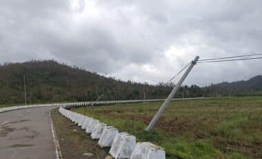
The storm, which intensified due to a powerful jet stream crossing the Atlantic, has caused serious infrastructure damage. A historic pier in Devon was destroyed and part of a sea wall collapsed, leading to suspended rail services between Exeter St Davids and Plymouth. Meteorologists have warned that unsettled conditions will persist throughout the week.
Widespread Damage and Disruption as Storm Moves East
The impact of Storm Ingrid has been felt particularly strongly in the South West of England, where coastal areas experienced strong gales and flash flooding over the weekend. According to the Met Office, a section of sea wall protecting a key railway line crumbled, prompting significant travel disruption. Rail services between Exeter St Davids and Plymouth were suspended in response to the damage.
In Devon, a historic pier was washed away by storm surges, underlining the intensity of the weekend’s weather. The storm is being driven by a strong jet stream across the North Atlantic, fuelled by a large temperature contrast over North America, according to Met Office meteorologist Tom Morgan. As the jet stream pushes into the UK, it continues to power a series of low-pressure systems.
Further yellow warnings have been issued, with eastern Scotland and Northern Ireland set to face continued rainfall into Sunday morning. Additional alerts are also in place for south-west England, south Wales and parts of Northern Ireland through Monday and Tuesday.
Flood Alerts Rise as Heavy Rain and Winds Persist
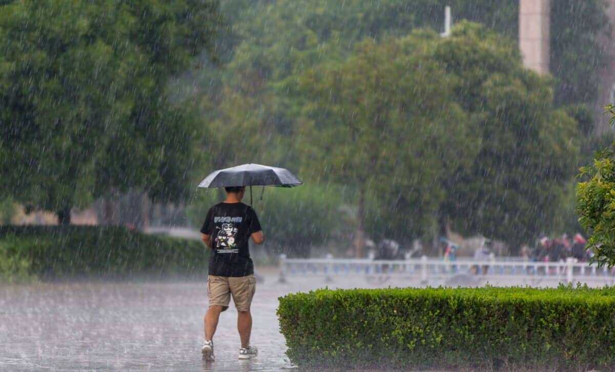
Nearly 150 flood alerts have now been issued across the UK, with warnings in effect for most regions except Wales, Scotland, Suffolk, Norfolk, and parts of Cheshire and Lancashire. According to the Met Office, up to 50mm of rain is expected in the worst-affected areas, with most regions likely to see 20–40mm. The heavy rainfall, combined with already saturated ground, increases the likelihood of flooding and travel disruption.
Power cuts and interruption to other essential services are expected where conditions worsen. According to meteorologist Aidan McGivern, low-pressure systems are forecast to bring “gusty winds and spells of at times heavy rain into the south and south Wales“. Along coastal areas, wind speeds may approach gale force, creating additional hazards.
Cold conditions are also expected to return, particularly in the northeast, with the possibility of snow falling on higher ground in northern England and Scotland on Tuesday. According to the Met Office, there is a small chance of disruptive snow on highland routes, which may further complicate travel. Flooding of homes and businesses remains a possibility, and some roads are expected to become impassable.