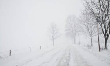
A significant snow event is forecast to hit parts of the United Kingdom before the end of January, with new data indicating the potential for deeper and more widespread snow than initially expected. The outlook is based on updated models from WX Charts, suggesting that the UK could be facing its most severe snowfall of the winter so far.
The prospect of heavy snow and sharp drops in temperature has already raised concerns among forecasters and transport services, particularly in Scotland and northern England, where accumulations could reach up to 70 centimetres. According to Birmingham Live, these figures are considerably higher than the 32cm previously expected. The situation is developing amid an already unsettled period marked by persistent cloud, rain, and fluctuating temperatures.
Central and Northern Regions Likely to Bear the Brunt of Snowfall
Forecast maps from WX Charts show a strong likelihood of heavy snow impacting central Scotland, with some areas potentially receiving as much as 71cm by the evening of 31 January. The Scottish Highlands are predicted to see snow cover stretch down towards the south coast, marking a considerable expansion in affected areas compared to earlier models.
Northern England is also expected to experience significant snowfall, particularly along the Pennines and the border between Cumbria and Northumberland, where up to 24cm of snow could fall. These accumulations are likely to affect both rural and urban areas, raising the possibility of widespread transport disruption and school closures.
Temperatures are expected to plunge sharply, especially in central Scotland, where lows of -14°C are forecast on 30 January. While other parts of the UK will likely remain just above freezing, forecasters warn that frost and ice may develop overnight due to intermittent clear spells. These conditions could make both driving and walking hazardous, especially in poorly gritted areas.
Changeable Conditions Complicate Short-Term Forecasts
While the long-range models point to heavy snow towards the end of the month, the short-term forecast remains variable. According to BBC Weather, the start of the week is expected to be mostly dull, with low cloud, persistent rain, and fog particularly affecting central areas. Brighter skies are anticipated across northern Scotland, but most regions will remain under cloud cover.
Moving into mid-week, conditions are expected to become increasingly windy, particularly in the southwest, accompanied by locally heavy rainfall. The Met Office forecast for Wednesday through Friday notes a “changeable” pattern, with a mix of cloudy spells, occasional brightness, and frequent outbreaks of rain. Northern areas may begin to turn colder as the week progresses.
Forecasters continue to monitor the evolving patterns, with updates expected as confidence in the models improves. While projections beyond five days carry uncertainty, the growing alignment between different forecasting systems suggests that a significant snow event is becoming increasingly likely.


