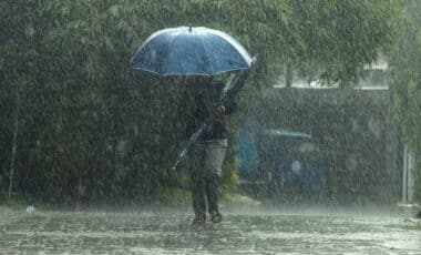
A 15-hour yellow weather alert has been issued by the Met Office for Thursday, September 4, affecting 70 regions across England and Wales. The warning is in place from 3am until 6pm. It signals the potential for thunderstorms, frequent lightning, and heavy rainfall, with possible consequences for surface water management and transport services.
According to information relayed by GloucestershireLive, the areas under alert span both urban and rural zones, with varying levels of expected impact. The Met Office advises ongoing monitoring of conditions throughout the day, as atmospheric instability may produce isolated but significant weather events across the warning area.
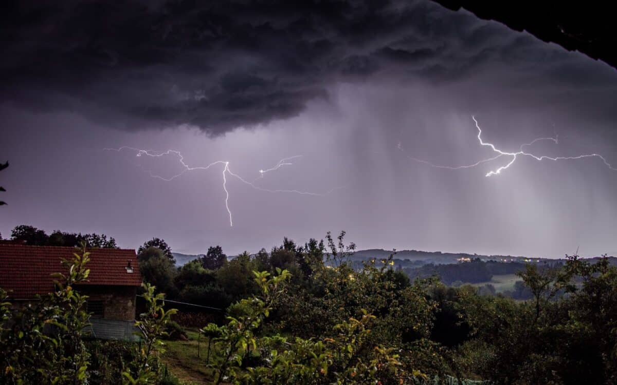
Thunderstorms Forecast to Hit Between 3AM and 6PM
The alert is in effect from 3am to 6pm and spans a wide area, including parts of the East Midlands, East of England, North East England, North West England, South West England, West Midlands, Yorkshire and Humber, and Wales. According to the Met Office, bands of heavy showers and thunderstorms are expected to move northeast across affected regions throughout the day.
A Met Office forecast stated:
Bands of heavy showers and thunderstorms are expected to move northeast across parts of England and Wales on Thursday. As showers progress northeastward they will become temporarily slow moving, leading to an increased chance of surface water flooding. Whilst the vast majority of places will have either non-impactful rain or remain dry, a few places within this area could see 30–60mm in an hour. Hail and lightning will be additional, possibly locally impactful, hazards.
Rainfall Estimates Range From 30MM to 80MM in Some Areas
The heaviest downpours are expected to be localised, with widespread totals reaching around 30mm, and coastal sites potentially receiving up to 80mm of rain. The thunderstorms may also be accompanied by hail, lightning, and strong gusty winds, with recorded gusts already reaching 45mph by Wednesday afternoon.
Meteorologists Highlight Uncertainty and Variability
Ellie Glaysher, a meteorologist at the Met Office, emphasized the unpredictable nature of the storms:
If everything comes together and you see the right shower in the right place, you could see half a month’s rainfall within a couple of hours.
With the nature of a thunderstorm warning, and the nature of showers, not everywhere will see that much rainfall – some people might obviously not see any rainfall within that warning area.
She added that hail, lightning, strong gusty winds, and sudden downpours remain possible throughout the day.
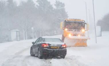
Disruption Possible During Morning and Evening Rush Hours
The Met Office warned that rush-hour commuters could experience delays, disruptions to public transport, and difficult driving conditions, particularly during periods of intense rainfall. Spray, reduced visibility, and surface water flooding could lead to road closures or hazardous conditions.
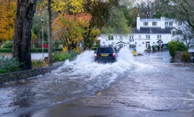
Risk of Flooding and Agency Response
The Environment Agency (EA) has also issued alerts related to potential surface water flooding. Dane Broomfield, duty flood manager at the EA, commented:
Persistent heavy rain and thundery showers mean minor surface water flooding is probable across parts of England today, with significant impacts possible but not expected on Thursday.
Environment Agency teams will be out on the ground and supporting local authorities in responding to surface water flooding.
He also urged caution for motorists:
We urge people not to drive through flood water – it is often deeper than it looks and just 30cm of flowing water is enough to float your car.
Affected Regions in Full
The following areas are under the yellow thunderstorm warning:
Yorkshire and Humber
- East Riding of Yorkshire, Kingston upon Hull, North East Lincolnshire, North Lincolnshire, North Yorkshire, South Yorkshire, West Yorkshire, York
East Midlands
- Derby, Derbyshire, Leicester, Leicestershire, Lincolnshire, Northamptonshire, Nottingham, Nottinghamshire, Rutland
East of England
- Peterborough
North East England
- Darlington, Durham, Hartlepool, Middlesbrough, Redcar and Cleveland, Stockton-on-Tees
North West England
- Blackburn with Darwen, Blackpool, Cheshire East, Cheshire West and Chester, Greater Manchester, Halton, Lancashire, Merseyside, Warrington
West Midlands
- Herefordshire, Shropshire, Staffordshire, Stoke-on-Trent, Telford and Wrekin, Warwickshire, West Midlands Conurbation, Worcestershire
South West England
- Gloucestershire, South Gloucestershire
Wales
- Blaenau Gwent, Bridgend, Caerphilly, Cardiff, Carmarthenshire, Ceredigion, Conwy, Denbighshire, Flintshire, Gwynedd, Merthyr Tydfil, Monmouthshire, Neath Port Talbot, Newport, Pembrokeshire, Powys, Rhondda Cynon Taf, Swansea, Torfaen, Vale of Glamorgan, Wrexham