The UK is bracing for a significant weather shift as tropical Storm Erin, which has already caused devastation in Cape Verde, heads towards the North Atlantic. Expected to affect the UK later this month, Erin is set to bring heavy rain and strong winds, challenging the current warm, dry spell.
Authorities are monitoring Erin closely, as its path could have severe implications for the nation’s weather, particularly in southern and western regions. This shift comes after the UK enjoyed an extended heatwave, with temperatures reaching 33.4°C in London earlier this week. As Storm Erin intensifies, its interaction with the jet stream is likely to influence the final outcome, making this a particularly unpredictable situation.
Storm Erin’s Impact on Cape Verde
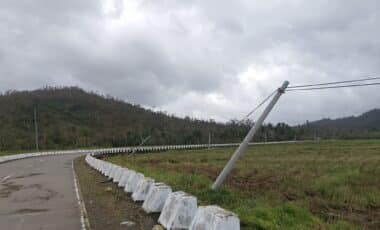
Tropical Storm Erin’s trajectory so far has been marked by destruction, particularly on the islands of São Vicente and Santo Antão in Cape Verde. The storm, which hit the archipelago off the west coast of Africa, has caused widespread damage, with authorities declaring a state of emergency.
Nine people have tragically lost their lives, and approximately 1,500 individuals have been forced to evacuate their homes. The storm’s intensity has highlighted the devastating power of tropical systems, with heavy rainfall and strong winds causing major disruption.
According to the National Hurricane Centre, the storm’s strength is expected to impact the Leeward Islands, Bermuda, and potentially the east coast of the United States. Its effects on the UK remain a key point of concern, as it heads into the North Atlantic.
The UK’s Weather Forecast as Storm Erin Approaches
As the UK transitions out of its heatwave, Storm Erin is expected to bring significant changes, particularly to southern and western areas. The Met Office has warned that heavy rain, thunder, and strong winds are all likely in the coming weeks, with possible disruptions to travel and outdoor activities.
According to Met Office spokespersons, while the specifics of the storm’s impact remain uncertain, the UK can expect a shift in weather patterns as high pressure retreats northwards.
With the storm likely to reach the UK in the latter part of August, the exact effects will depend on its interaction with the jet stream. Tropical systems like Erin can either enhance or diminish weather conditions depending on their position relative to the stream, sometimes causing prolonged wet or dry spells. Given that Erin’s path remains uncertain, UK residents are being urged to stay updated on the evolving forecast.