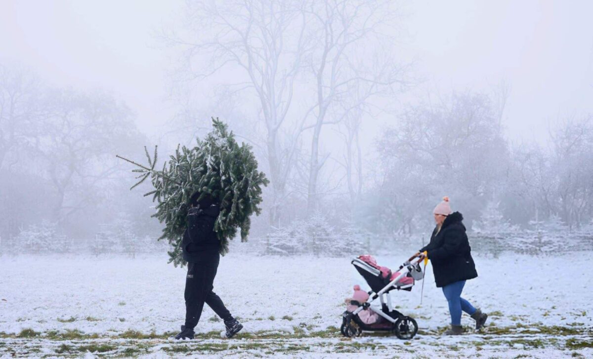
The UK is shrouded in uncertainty ahead of the festive season, with weather forecasts predicting snowstorms, freezing conditions and the possibility of a white Christmas. Meteorologists predict that a significant snowstorm will hit just days before Christmas, bringing with it a cold snap and snowfall across much of the country.
Snowstorm Expected Across the UK
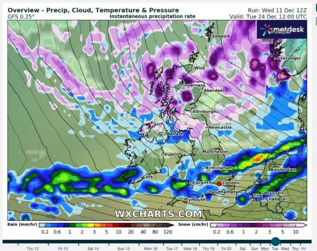
The UK is bracing itself for a powerful weather system that could bring heavy snow in the lead-up to Christmas. According to forecasts from WXCharts and the Met Office, a snowstorm is expected to arrive on Christmas Eve, affecting regions from Wick in Scotland to Birmingham.
Certain areas, particularly in northern Scotland, could see snowfalls of up to 20 cm per hour, while cities like Edinburgh and Glasgow are likely to experience substantial snow accumulation. The snowstorm is set to impact the North West, North East, and Central Scotland, with parts of the South East and London experiencing wetter conditions instead.
Polar Vortex to Bring Freezing Temperatures
In addition to the snow, a Polar vortex is predicted to bring freezing temperatures across much of the UK. In some regions, temperatures could plummet to as low as -6°C, with particularly cold conditions forecast for central Scotland. WXCharts also warns that the Polar vortex may bring up to 22 cm of snow to parts of north-west Scotland, with southern areas expected to experience lighter snowfalls.
On Christmas Eve, temperatures in Scotland could dip as low as -4°C, and Boxing Day is expected to bring similarly sub-zero conditions. This cold snap is also expected to bring frost and fog during quieter periods, especially in southern regions like London and Cardiff.
A White Christmas Still a Possibility
For those hoping for a White Christmas, there is still reason to be optimistic. The Met Office defines a White Christmas as any trace of snow falling during the 24-hour period of Christmas Day. Although southern parts of the country may experience milder temperatures, northern regions, such as Scotland, northern England, and Northern Ireland, still have a strong chance of snowfall.
Cities like Edinburgh, Glasgow, and Newcastle could see snow on Christmas Day. According to the Met Office, certain areas in the north may see light snow on Christmas Day, even if southern locations, including London, only experience rain.
Unsettled Weather Throughout the Festive Period
After Christmas, the UK will continue to experience unsettled weather, with a mixture of rain, wind, and snow. The Met Office forecasts that from 16 December to 8 January, the UK will experience a variety of conditions, ranging from mild and wet weather to windy spells.
Southern and central regions are expected to see predominantly wet weather, while snow flurries are more likely in higher ground in the north. Additionally, frost and fog are expected to affect areas such as London and Bristol during more settled spells.
While southern England may face milder temperatures and rain, the north is likely to experience a much colder Christmas, with snow being a strong possibility. Scotland, in particular, could see heavier snowfalls, with 20 cm of snow expected in places like Aberdeen and Inverness.
The Polar vortex is expected to dominate the UK’s weather from 24 December onwards, creating a stark contrast between the colder north and milder southern weather. The Met Office has also highlighted that frost and fog will contribute to the wintry atmosphere during the period around New Year’s.

