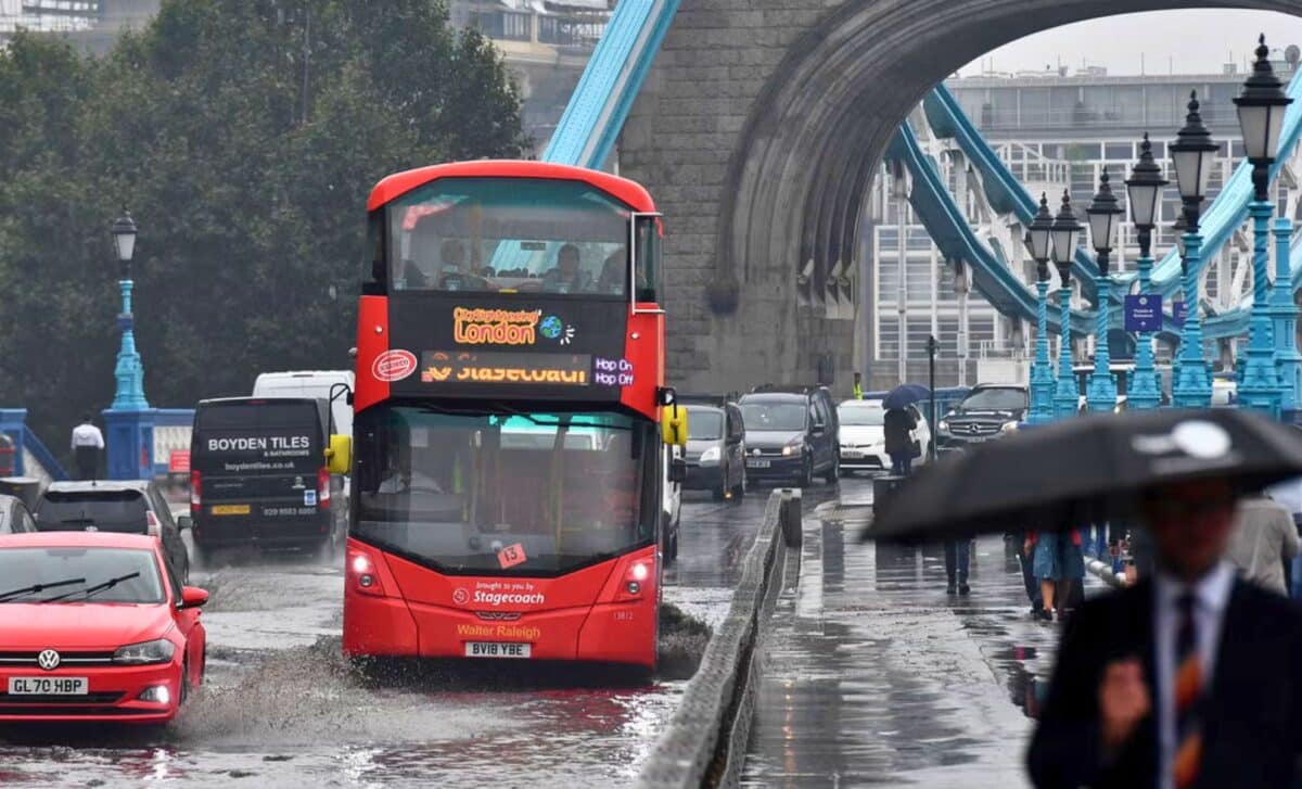
The UK has switched from enjoying the hottest day of the year to preparing for heavy rain and possible floods. The Met Office has warned that British families should get ready for what could be a very difficult weather conditions over the coming days.
From Heatwave to Deluge: What to Expect
After a brief heatwave, especially in the south and east, there is now likely to be a westerly airflow across the country, bringing showers and longer spells of rain.
This change in weather will bring temperatures back down to something more typical of this time of year, which is a far cry from just a few days ago when it was sizzling hot.
Prepare for Flooding
The Met Office is not taking any chances with its forecast. Heavy rain is expected, and they are telling everyone to “prepare a flood plan.” It’s simple but critical counsel: find out whether your home is susceptible to flooding and take necessary actions.
“If you are at risk, take the next two steps to protect your property: prepare a flood plan and prepare an emergency flood kit,” warns the Met Office. It’s clear that action needs to be taken without delay-even before water starts rising.
Staying Safe During Floods
Safety is paramount when dealing with floods, and the Met Office has laid out some essential steps to keep you and your loved ones safe.
- If floodwater traps you inside a building, head to the highest level, but avoid the attic unless it’s the last resort.
- If necessary, move to the roof and call 999 for help.
- Don’t forget the small but important details—like making sure your mobile phone is fully charged.
Cloudy across parts of England and Wales with patchy rain and drizzle ☁️
Brighter elsewhere with sunny spells 🌤️
Turning breezy in the northwest later 🌬️ pic.twitter.com/VBtX0xDQAf
— Met Office (@metoffice) August 14, 2024
Monday’s Record-Breaking Heat
It was only a matter of days when some people in the UK rejoiced in the hottest day for two years, with Cambridge temperatures rising to 34.8 °C. This record high is yet provisional since August 2022.
But just as quickly as the heat came, it appears that the weather has now turned with cooler and wetter conditions expected to take over, especially across the north.
Although there might be a little warmth and sunshine for southeast England on Tuesday, temperatures will still peak between 27 °C and 29 °C for almost everywhere else in the country.
The Atlantic jet stream is making its presence felt, meaning we could anticipate some changeable weather patterns due to mixtures of milder and wetter conditions in coming days.
5-DAY Weather Forecast for the UK: Wednesday 14 August – Sunday 18 August
Today:
- Rather cloudy with some patchy rain and drizzle across central and eastern England, although slowly brightening up here later.
- Otherwise, a largely fine and dry day with spells of sunshine, but turning cloudy and windy later in the far northwest.
Tonight:
- Rain and strong winds will spread across much of Scotland, Northern Ireland and parts of northern England overnight.
- Dry, with clear spells elsewhere and fresher than of late.
Thursday:
- Rain across the north will slowly spread southwards throughout the day, but many southern and central parts remaining fine and dry throughout.
- Brightening up across Scotland and Northern Ireland later.
Outlook for Friday to Sunday:
- Rain at first in the southeast on Friday, otherwise largely dry and bright, with some showers in the west.
- Remaining similar over the weekend, with temperatures around average.


