As Britons gear up for what could be a scorching summer, the latest weather forecast from the Met Office has caught everyone’s attention. It seems that heat is on the horizon, with temperatures expected to reach 22 degrees Celsius in Yorkshire. In particular, the North East of England and the Midlands look set to experience the hottest weather on May 23.
According to the Met Office, while the risk of a heatwave remains relatively low, it is slightly higher than usual this year. However, this subtle change in the temperature forecast suggests that it would be prudent to prepare for a period of warmer weather in the coming days.
Moreover, the Met Office’s latest heatwave risk assessment follows comments by weather expert Jim Dale to the Express suggesting that Britain could face record heatwaves this summer.
Highlights of Regional Temperatures
London is expected to see a maximum temperature of 22 degrees Celsius, while Northern Ireland could exceed this figure with a forecast of 23 degrees.
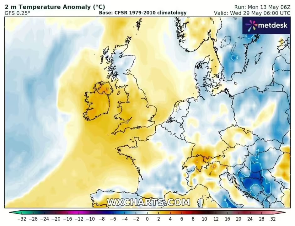
Based on data from the Met Office, a map shows that much of England, Wales and Northern Ireland could be one to two degrees warmer than the seasonal average by 6am on 29 May.
Maximum temperatures across much of the UK are expected to be in the tens of degrees on 28 May. While the south-east of England could see temperatures between 17 and 19 degrees Celsius.
Other regions such as the south-west, the Midlands, East Anglia and parts of the north-east could see temperatures between 16 and 18 degrees Celsius.

Long-Range Weather Forecast
The Met Office’s long-range weather forecast for the period 28 May to 11 June shows a mixture of rain, showers and calm periods, potentially interspersed with warm interludes.
If the risk of above-average and below-average rainfall is balanced between now and the start of June, the likelihood of above-average temperatures is slightly higher, raising the possibility of heatwaves, although they are still few and far between.
The French weather map for 23 May shows maximum temperatures of 19 degrees Celsius in Brittany and Normandy, suggesting the possibility of heat drifting across the Channel into Britain.
From the Hottest Day of the Year to Milder Conditions with Thunderstorms
On Sunday 12 May, the UK experienced its hottest day of the year, with temperatures reaching record highs. Forecast models are predicting a period of more moderate weather over the coming week, with thunderstorms set to interrupt the fine weather.
Chertsey, in Surrey, recorded the highest temperature on Sunday, at 27.5 degrees Celsius, while Usk, in South Wales, reached 25.3 degrees Celsius.


