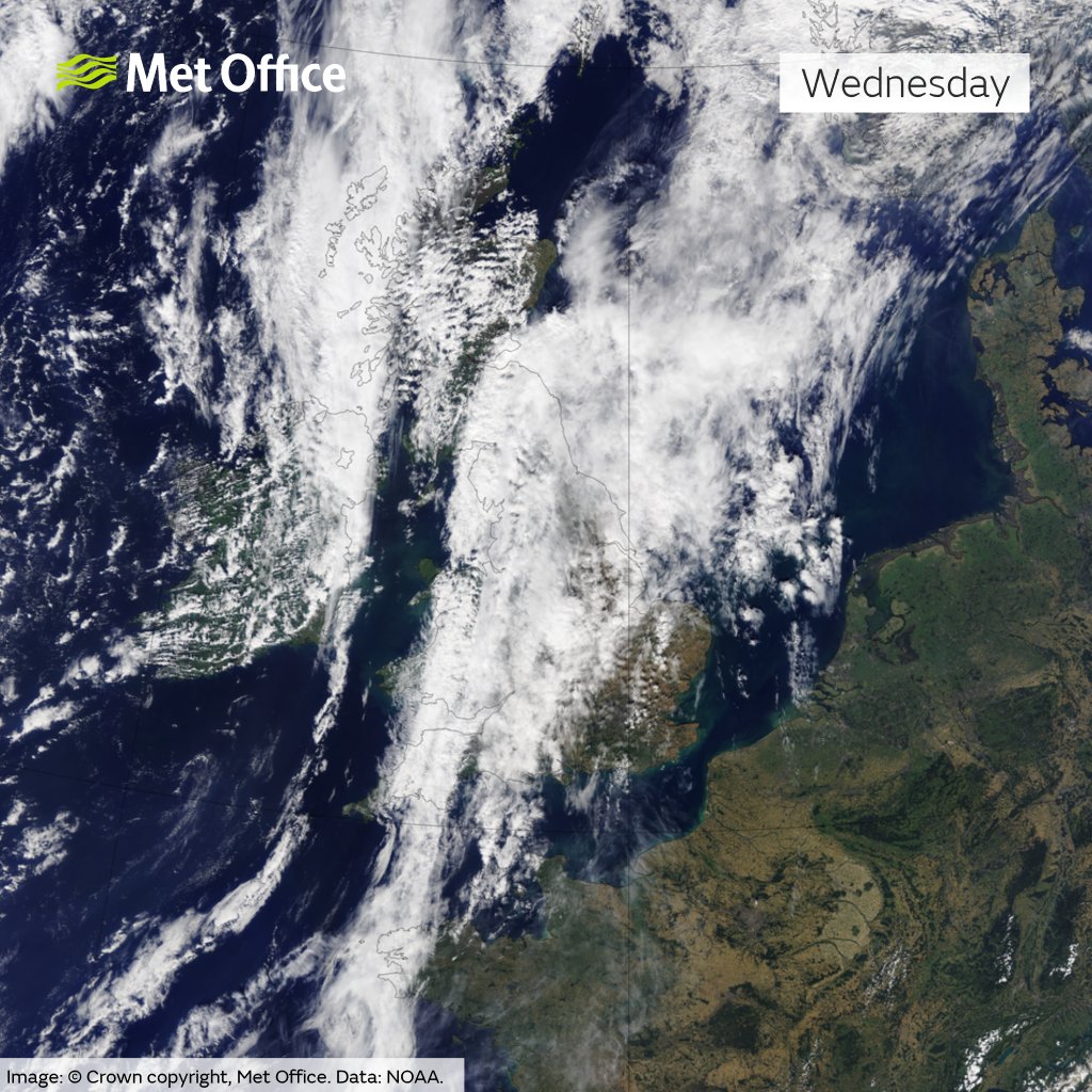
As August turns into September, summery tendentiousness ends gradually, in the UK 28 August 2024 presented one day with a multitude of different weather types. Today varied from cool and overcast in the north to warm and partly sunny in the south.
A Mixed Weather Across the UK Today
Morning: A Cloudy Start for Many
The beginning of the day saw large areas of the UK and Ireland experiencing all-over cloud cover, with surface temperatures typical for the cool late summer. In Scotland, Stornoway experienced a cool 15 °C start under overcast skies, while Wick was slightly warmer at 17 °C but remained cloudy.
Inverness saw temperatures of 20 °C, though clouds dominated the skies, and Aberdeen matched this cloudy trend at 19 °C. However, Dunbar had a more favourable morning with some sunshine and a pleasant 22 °C.
Western Scotland and Northern Ireland had a similar story. The Isle of Mull remained chilly at 16 °C with showers, and Glasgow recorded 20 °C under mostly cloudy conditions. Belfast experienced a mild 19 °C, accompanied by light rain showers.
Across England and Wales, Liverpool saw a cloudy 19 °C, while Birmingham reached a milder 22 °C, though the sky remained overcast. York was cooler at 21 °C under grey skies. London, however, enjoyed warmer conditions at 25 °C despite heavy clouds, while Norwich, the warmest spot, peaked at 27 °C under cloud cover. Further west, Cardiff and Plymouth each recorded 20 °C, experiencing mostly cloudy conditions.

Afternoon: A Gradual Shift
As the day progresses, some localized areas do get better with some clearings of the cloud cover, but the general picture remains fuzzy. In Scotland, Stornoway, and Wick continue with cool and cloudy conditions, showing little change from the morning. Inverness stays mild at 23 °C, but clouds linger. Aberdeen and Dunbar maintain their morning conditions with no major shifts.
Across England and Wales, London and Norwich continue to enjoy warmth with 25 °C and 27 °C, respectively, and some sun breaks through. Liverpool, Birmingham, and York remain cloudy with mild temperatures, showing little change from the morning.
A northwest-southeast split across the UK today
Mostly dry with hazy, warm sunshine in the southeast 🌤️
Cooler and cloudier across the northwest with outbreaks of rain turning heavy at times during the afternoon 🌧️ pic.twitter.com/5t3JFqtHLX
— Met Office (@metoffice) August 28, 2024
Evening: A Cool, Mixed Nightfall
Come evening, temperatures will start to drop as in some places the skies will be beautifully clear, and in some, the overcast will remain. Scotland’s Stornoway and Wick will continue with a cool, cloudy evening, with temperatures slightly dropping. Inverness will hold steady at 23 °C, though the clouds will persist, while Aberdeen will experience a mix of clouds and clear spells with temperatures around 19 °C.
As night falls across England and Wales, London will enjoy a warm, clear evening at 25 °C, while Norwich will remain warm at 27 °C, though clouds will linger. Cardiff and Plymouth will both see temperatures drop to 20 °C under partly cloudy skies.
Met Office 5-Day Weather Forecast
This Evening and Tonight:
- Rain and showers across England will clear during the evening, leaving many areas with clear spells.
- A scattering of showers will continue across some western areas, heaviest and most frequent across the far northwest.
- Cooler than last night.
Thursday:
- A fine and dry day for many eastern, central and southern parts of the UK.
- A mix of sunshine and showers elsewhere, with a risk of thunder in Scotland.
Outlook for Friday to Sunday:
- Mostly fine and dry on Friday and Saturday across the UK.
- Cloudier on Sunday, with a risk of some rain reaching the far northwest and some thunderstorms across the south.


