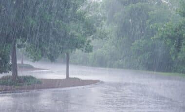
The United Kingdom is set to receive heavy rain and thunderstorms which are expected to pose a threat to lives, hence leading to issuance of weather warnings for much of the country.
Thunderstorm Warning for Wales and Western England
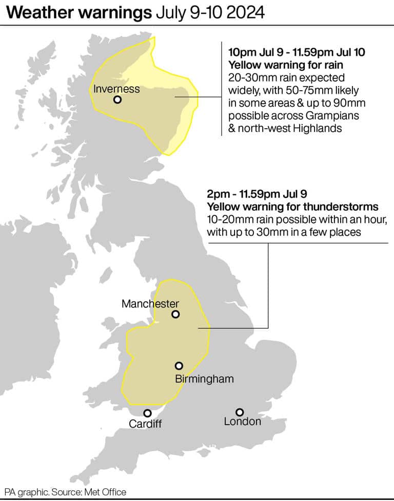
On Tuesday and Wednesday, two yellow weather alerts are issued. The thunderstorm alert shall cover Wales and parts of western England while in the northern Scotland, there will be a rain warning before showers up to 90mm.
Tuesday and Wednesday this week shall have two yellow weather alerts. This storm alert covers most parts of Wales, including places like Powys and Gwynedd, as well as some regions in western England such as Manchester; Birmingham.
On Tuesday, from 2 pm until midnight, the Met Office predicts that there will be thundery downpours across much of Wales. Thereby, it could lead to localized flooding.
Some areas could see 10-20mm/hr rainfall rates, with a few hours recording around 30mm. Motorists should anticipate travel disruption due to flooded roads and spray.
Furthermore, there is a slight possibility that residential homes or business premises may be affected by flooding or hit by lightening.
Cloudy with outbreaks of rain sinking southwards across Scotland, Northern Ireland and northern England this evening ☔
Drier further south with some late sunshine 🌤️ pic.twitter.com/ylodUOCBY2
— Met Office (@metoffice) July 10, 2024
Rain Warning for Northern Scotland
A different yellow weather warning exists for northern Scotland, with the worst-hit places expecting up to 90 mm of rainfall from 10 pm on Tuesday through to around midnight on Wednesday.
Rainfall is expected to be widespread and varied between 20-30mm but could be as much as 50-75mm in certain areas like: Angus, Aberdeenshire, Moray and Highlands which are going to face unsafe driving conditions while some communities may have access problems caused by flooded roads.
The met office has warned that fast flowing, or deep floodwater could pose a danger to life. Train and bus services could also be cancelled.
On Tuesday and Wednesday there will be unpredictable weather characterized by bursts of rain and humid conditions throughout the UK before becoming drier and slightly warmer at the end of the week.
Central England is set for its warmest spell this week when temperatures reach highs of around 22° C on Wednesday. In contrast, rural Scotland may record temperature lows of about 3°C late Thursday night.
Met Office 5-DAY Weather Forecast
This Evening and Tonight:
- Rain across the north, gradually moving a little further south throughout the night.
- Southern England and south Wales remaining mostly dry with clear spells, but feeling a little cooler.
- Mist and fog patches likely to form in rural sports.
Thursday:
- Outbreaks of rain continuing to affect central areas throughout the day, but rain tending to be lighter and more patchy.
- Drier and brighter in either side and remaining cool for many.
Outlook for Friday to Sunday:
- Sunshine and showers on Friday, before a risk of rain moves across eastern areas later and into Saturday.
- Drier but rather cloudy over the weekend, with still some showers.