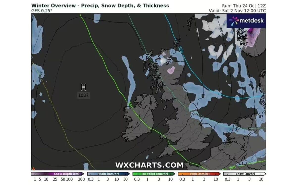
On November 2, weather forecasts expect temperatures to drop to -2C, as arctic winds sweep across the country. Maps from WXCharts show that this arctic air mass will reach all the regions of Britain and extend from Wick in the North of Scotland to London in the South.
Upcoming Cold Snap
The weather patterns witnessed so far in October have been quite diverse throughout the UK, with some areas especially in the north, western England, and the Midlands recording above-average precipitation.
For example, Chillingham Barns located in north Northumberland has already recorded almost twice the amount of rainfall it usually expects by this stage in the month.
As it stands, fresh forecasts suggest that by the 2nd of November, parts of the region around Aberdeen are expected to see temperatures fall to -2C, with some snow also possible. Other towns such as Edinburgh, Inverness, Wick, and Newcastle are also likely to see highs of about 0 to -1C.
Met Office Long-Range Forecast
The Met Office‘s long-range forecast for the period from October 30 to November 8 indicates a predominance of calm and settled weather, attributed to a dominant area of high pressure. The forecast states:
“The period is likely to be characterised by often quiet and settled weather… Some mist and fog is probable in the south at first…” Met Office
For colder and clearer conditions with the chance of snow falling in the northern and eastern parts of the UK as November sets in are still very much a possibility. The cold snap, however, is not expected to affect the rest of the UK and instead, many areas will continue to experience cooler weather.

Weekly Weather Outlook
In the short-term forecast, the Met Office has noted that a weakening band of rain will advance north and east across England and Wales, leading to low clouds and mist. Northern Ireland will also face patchy rain. Following this, brighter intervals and showers are expected, alongside mild but windy conditions, particularly in the far southwest of England.
Tonight
- Rain is anticipated to clear from most regions, except for the far northwest, leading to predominantly dry conditions elsewhere.
- Light winds and clear skies may result in patchy mist and fog, especially in central and eastern areas.
Saturday
- Heavy rain is projected to move eastward across northern regions.
- The south will remain drier, with occasional bright or sunny spells following the dissipation of early mist and fog.
Sunday to Tuesday
- The weather will begin mostly dry, but locally heavy rain is anticipated to move southeast into Monday.
- By Tuesday, a drier and more settled weather pattern is expected to take hold.
- Overall skies will remain rather cloudy, with temperatures stabilising around average.


