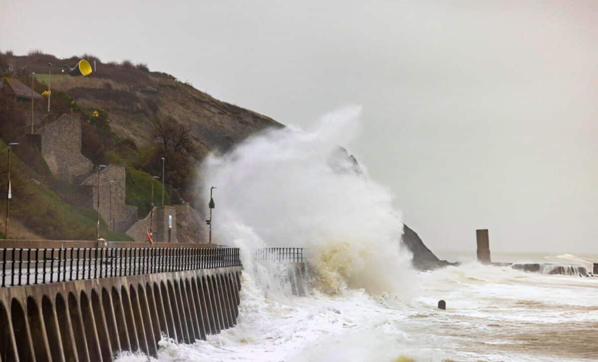
The UK is preparing for a prolonged weather event this weekend, as Storm Darragh is forecast to bring a 57-hour snowstorm, accompanied by gale-force winds, heavy rain, and snowfall across multiple regions. Beginning on Friday evening, the storm will affect parts of northern England, with several areas bracing for challenging conditions that could cause significant disruption, including travel delays, power outages, and flooding risks.
A Dangerous Weather Warning Issued Across the UK
The Met Office has issued a ‘danger to life’ warning as part of a four-day yellow weather alert for parts of the UK. The warning will be in effect from Thursday, December 5, through Sunday, December 8, with several areas expecting severe weather.
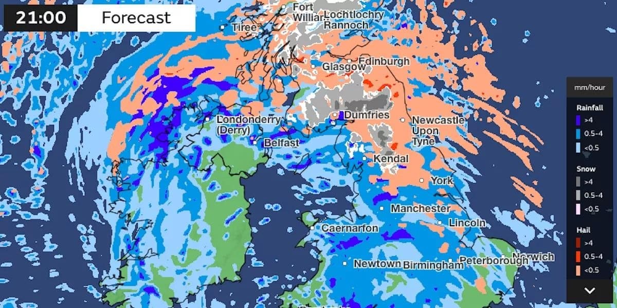
Snow is expected to fall heavily across Cumbria, Northumberland, Yorkshire, and other northern regions, with accumulations of up to 6 cm in places such as southern Newcastle and Hull by Saturday, December 7. As the storm progresses, conditions will worsen, and parts of the East Coast are expected to experience wind speeds of up to 100 km/h by Sunday, December 8.
In a statement, the Met Office outlined that there will be a “risk of injuries and danger to life from flying debris”, particularly in areas exposed to the strongest winds. Higher ground is also expected to see significant snowfall, which may cause additional disruption.
Storm Darragh’s Impact on Travel and Safety
The storm will bring gale-force winds and snow across affected areas, causing dangerous driving conditions and travel disruptions. The Met Office has warned that:
“There is a small chance of injuries due to flying debris, and some areas of higher ground could see heavy snow showers.”
The combination of strong winds, heavy rain, and snow is expected to lead to widespread travel difficulties, particularly along coastal regions and in areas with higher altitudes. The storm will affect rail services, with potential delays and cancellations, and air travel could also be impacted due to the severe conditions.
The Met Office also cautioned about the risk of flooding due to the heavy rain expected to fall across northwest England and Wales, where up to 70 mm of rain could accumulate in some locations, further exacerbating the risk of disruptions.
#StormDarragh has been named and is forecast to bring very strong winds and heavy rain to the UK later on Friday and through the weekend #WeatherAware ⚠️ pic.twitter.com/xqPH9hvqxs
— Met Office (@metoffice) December 5, 2024
Expected Weather Conditions Across Main Areas Affected
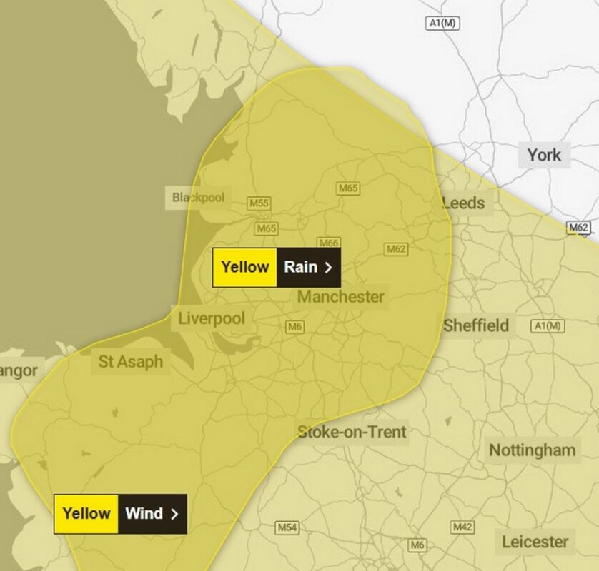
The storm will make landfall on Friday evening, with the heaviest snow and rain expected to affect Lancashire, Cumbria, and Greater Manchester by late afternoon. The Met Office has issued additional yellow warnings for rain, wind, and snow that will remain in place until Sunday.
Regions and local authorities affected:
East Midlands
- Derbyshire
North West England
- Blackburn with Darwen
- Blackpool
- Cheshire East
- Cheshire West and Chester
- Cumbria
- Greater Manchester
- Halton
- Lancashire
- Merseyside
- Warrington
Wales
- Conwy
- Denbighshire
- Flintshire
- Gwynedd
- Powys
- Wrexham
West Midlands
- Shropshire
- Staffordshire
- Stoke-on-Trent
Forecast Breakdown (Friday to Sunday):
- Friday: Expect heavy rain and snow by late afternoon, with conditions worsening in the northwest.
- Saturday: Winds will intensify, and snowfall will become more widespread, particularly across northern regions.
- Sunday: Winds will reach 100 km/h along the east coast, with hail and snow across exposed higher altitudes.
What the Public Should Expect and How to Prepare
As Storm Darragh moves across the UK, the Met Office is urging the public to take precautions. Travel will be severely affected, and individuals living in regions under weather warnings should remain cautious. Snow, strong winds, and flooding risks will persist throughout the weekend, and it is advised that people:
- Avoid unnecessary travel in areas experiencing snow and winds.
- Secure property and outdoor objects, particularly in areas exposed to gale-force winds.
- Remain alert to the potential for flooding in vulnerable areas such as Lancashire and Wales.
Safety Tips:
- Regularly check weather warnings from the Met Office and local authorities.
- Stay indoors during periods of intense snow and strong winds.
- If travel is necessary, ensure your vehicle is equipped with snow chains, warm clothing, and emergency supplies.
It is imperative to remain informed about any new warnings or updates as Storm Darragh advances through the UK, thereby guaranteeing safety during this extended period of adverse weather conditions.

