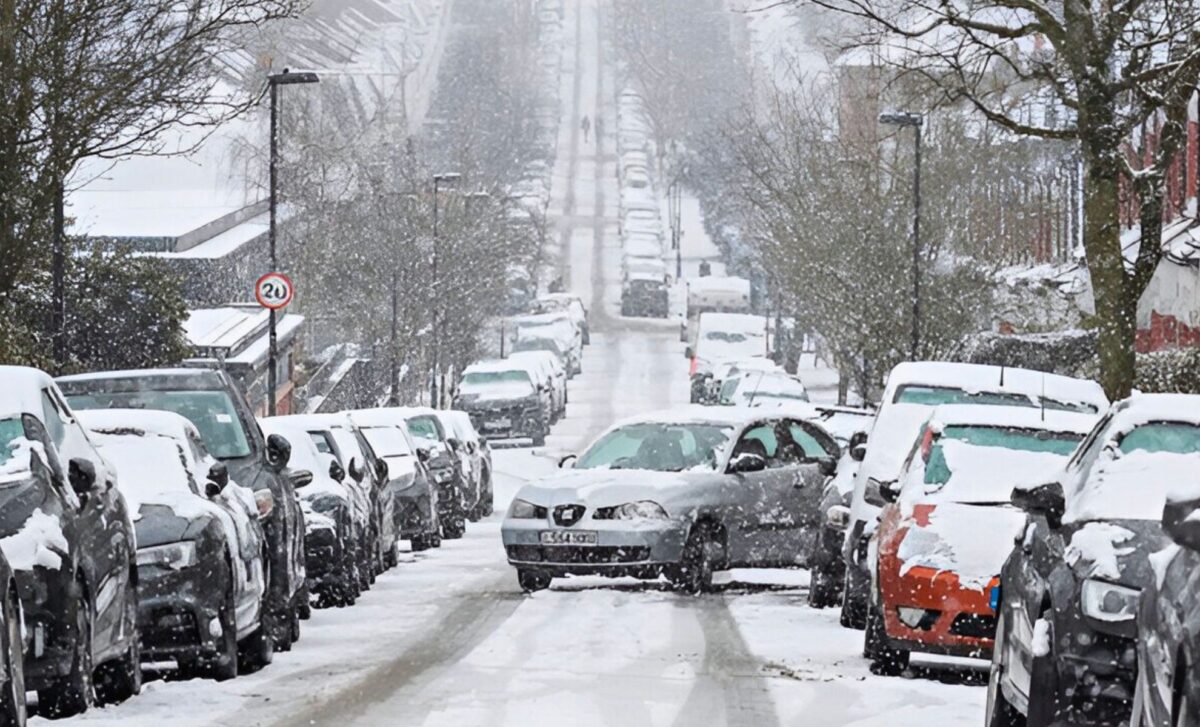
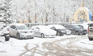
This December, the UK is gearing up for some major and unusual weather phenomena. A rare three-day weather warning has been issued, forecasting a mix of heavy snow, freezing rain, and strong winds. This comes on the heels of anticyclonic gloom, a weather phenomenon that brings cloudy skies, reduced visibility, and a persistent chill to much of the country.
Three-Day Weather Warning: Snow, Ice, and Strong Winds Expected
The Met Office has issued a three-day weather warning for several regions in the UK, from December 13 to 15, with a focus on northern and western areas. The warning is specifically for snow, freezing rain, and strong winds, which will affect regions such as Scotland, Northern Ireland, North West England, and parts of Wales.
⚠️ Yellow weather warning issued ⚠️
Rain across northwest Scotland
Sunday 1800 – Tuesday 1200
Latest info 👉 https://t.co/QwDLMfRBfs
Stay #WeatherAware⚠️ pic.twitter.com/MbkI4p50Nk
— Met Office (@metoffice) December 13, 2024
Snowfall and Ice Accumulation
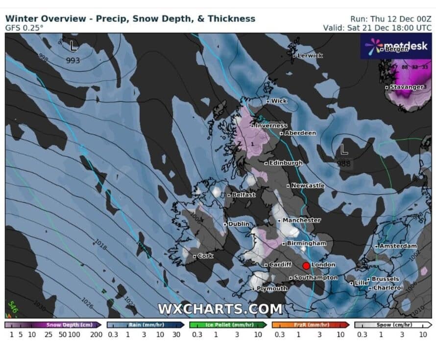
- Snowfall rates: According to forecast models from WXCHARTS and the Met Office, snowfall could accumulate at rates of up to 3 cm per hour in certain regions, particularly in the North West and Yorkshire. Snowfall accumulation is expected to be heaviest in higher elevations and areas prone to colder air, such as Scotland and the Pennines.
- Freezing Rain: The combination of wet snow and freezing rain is expected to create hazardous conditions, especially in the Midlands and South East, where temperatures will hover just below freezing. As a result, icy conditions could lead to dangerous travel situations on untreated roads and pavements. Freezing rain forms when supercooled droplets of water freeze upon contact with surfaces, creating a layer of ice. This can quickly build up and cause significant disruption.
- Winds: Strong winds will accompany the snow, exacerbating the chill and causing blizzard-like conditions in some areas. Winds are expected to reach 60-70 mph in coastal areas, with gusts even higher in the North West. The high winds could contribute to tree falls, power outages, and difficult driving conditions. These strong winds are characteristic of the polar maritime air mass moving down from the North Atlantic.
Boxing Day Brings a Wall of Snow Across the UK
On Boxing Day, a wall of snow will likely move across much of the UK, with up to 3cm of snow per hour expected in certain areas, according to the latest forecast from WXCHARTS. The North West, Yorkshire, and Mid-Wales are expected to bear the brunt of the snowfall, while parts of London and the South East may only experience lighter snow, sleet, or rain. Weather experts warn that the conditions could lead to disruption for travelers heading into the Christmas weekend.
Paul Gundersen, chief meteorologist at the Met Office, remarked that the intensity and speed of the snow are likely to cause travel headaches in rural areas where snow accumulation could be faster and heavier. He added that frost and ice will persist even in regions where snow does not accumulate, especially overnight.
Weather Patterns and Snow Intensity
The wall of snow expected on Boxing Day is the result of an incoming polar maritime air mass. This weather system is typical of winter storms originating from the North Atlantic and can cause rapid temperature drops and heavy snowfalls. The cold front arriving on Boxing Day will trigger frontogenesis, a process where air converges along a boundary between warm and cold air masses, intensifying upward motion and causing moisture to condense into heavy snow.
Southern England will likely experience lighter snow, with a mix of sleet and rain. The South East will be on the warmer side of the front, where the air is less conducive to snowfall. Temperatures in this region will be around 0°C to 2°C, causing sleet or light rain rather than heavy snow.
Anticyclonic Gloom: A Persistent Weather Phenomenon
Anticyclonic gloom occurs when a high-pressure system (an anticyclone) settles over an area, preventing upward motion in the atmosphere and leading to the formation of stratus clouds or fog. This weather pattern typically occurs in winter, when solar radiation is minimal, and the sun’s rays are too weak to lift the air and dissipate the clouds.
Mechanism Behind Anticyclonic Gloom
An anticyclone is a weather system characterized by high atmospheric pressure. In such systems, air tends to sink towards the ground, which inhibits the formation of clouds at higher altitudes. As a result, low-level cloud formation (fog or stratus clouds) becomes dominant. These clouds block sunlight and keep temperatures lower than they would be under a low-pressure system.
During the winter months, the sun’s angle is low, which means its rays have to travel through a thicker portion of the atmosphere. As a result, the sun has less power to break up the cloud cover or fog. Daylight hours are also shorter, which increases the likelihood of persistent gloom.
This type of weather is often associated with poor air quality, as pollutants such as nitrogen dioxide (NO2) and particulate matter become trapped under the dense cloud layer. Cities such as London and Birmingham may experience increased levels of air pollution during periods of anticyclonic gloom, as the lack of wind prevents the dispersion of these pollutants.
Impacts and Outlook: What to Expect
- Snow and Ice: The heavy snow expected in the North West and Mid-Wales will cause disruptions, particularly for road transport. A roads and minor routes in areas such as Yorkshire, Cumbria, and Scotland may become impassable, especially during overnight conditions when temperatures are expected to drop further. Drivers in these areas are urged to carry winter gear, such as snow chains, and ensure their vehicles are equipped for snowy conditions.
- Air Travel: Flight delays are expected, particularly at airports in the North and Scotland, where freezing rain could create hazardous conditions on runways. London airports, being on the southern edge of the front, are expected to experience lighter disruptions, but travelers should still anticipate delays and disruptions.
- Power Outages: In areas affected by high winds and heavy snow, power lines could be brought down, leading to local outages in rural regions. The Met Office has warned that these outages could last several hours, particularly in areas where the snow is wet and heavy.
Clearing Weather: Low-Pressure Systems and Windy Conditions
Later in the week, a low-pressure system will move in from the Atlantic. This will break up the high-pressure system and bring rain and stronger winds. The anticyclonic gloom is expected to clear by Saturday, with winds reaching up to 40-60 mph in some areas. These winds are expected to come from the west, bringing colder air from the polar regions.
Despite the clearing skies, temperatures will remain below average, especially in the North and Midlands, where frost and ice will persist. In the South, the weather will become somewhat milder, with temperatures rising to around 5°C to 8°C.

