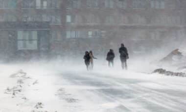
The UK is bracing for a significant drop in temperatures, with a snowstorm bringing heavy snowfall and freezing conditions expected across many regions from early December. This weather system, which could be one of the coldest spells in decades, is expected to bring notable disruptions, particularly to the north and west of the country.
Weather Forecast: A Sharp Drop in Temperatures
According to the latest reports from the Met Office, temperatures are set to plummet sharply from December 1st, with a cold front bringing freezing conditions, especially to northern parts of the UK. By December 9th, an intense snowstorm is expected to hit, primarily affecting higher altitudes in Scotland and Northern Ireland. Temperatures could reach as low as -6 °C, with the cold spell lasting for several days. Here’s a breakdown of what’s expected:
- Maximum temperatures: Expect a dramatic dip in the north, potentially as low as -6 °C.
- Snowfall: Starting around December 9th, with heavier snow likely at higher elevations in Scotland and Northern Ireland.
- Rain and winds: Particularly in the south and west, frequent rain showers and gusty winds of up to 50 km/h will be a concern.
The first areas to see snow will be northern Scotland and Northern Ireland, with significant snow accumulations forecast for the higher ground.
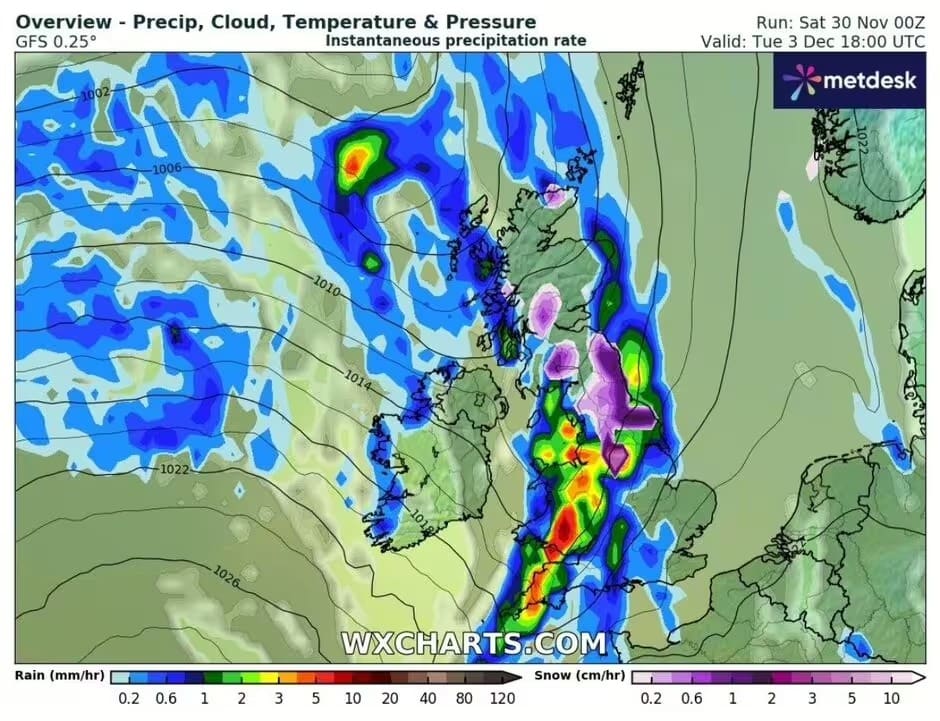
Areas at Greatest Risk of Snow
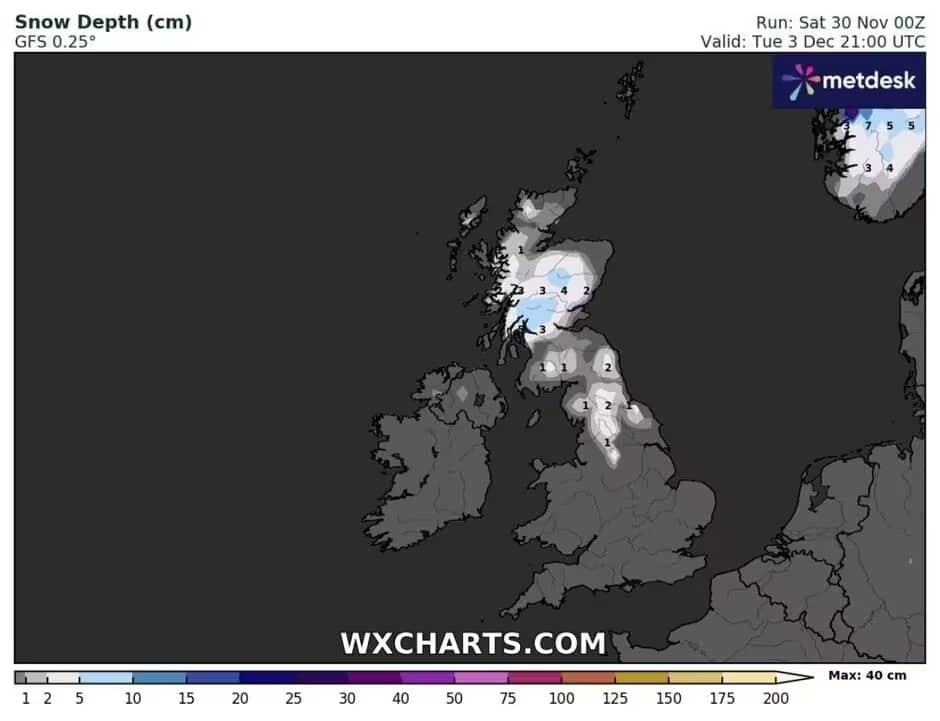
The regions most vulnerable to the approaching snowstorm include northern England, Wales, and parts of Northern Ireland. The forecast predicts particularly difficult conditions in higher areas, where snow could accumulate up to 4 cm in the Scottish Highlands. In contrast, the southern parts of the country are expected to avoid the heaviest snow, but rain and strong winds will begin to impact these areas from December 2nd. Here’s a summary of what’s expected in specific regions:
| Region | Expected Weather | Snowfall Forecast | Other Conditions |
|---|---|---|---|
| Northern Scotland | Snow, intermittent showers | Up to 4 cm in the Highlands | Freezing temperatures and moderate winds |
| Northern Ireland | Light snow | 1-2 cm on higher ground | Overcast skies with possible rain showers |
| Northern England | Local snow | 1-2 cm in the Pennines | Fog and strong winds |
| Southern England | Rain and wind | None | Persistent rain and gusts of wind |
Southern areas, such as Kent and Essex, are expected to remain largely unaffected by the heaviest snow, but they won’t escape the rain and strong winds sweeping in from the west.
Snowstorm’s Impact on Transport and Daily Life
As the storm approaches, travel disruptions are likely, particularly due to icy roads and heavy snow in higher-altitude areas. Authorities have already issued warnings urging caution, especially on roads in the north and west of the UK. Public transport services could also be delayed or suspended due to adverse weather conditions. Key impacts expected include:
- Roads: Icy conditions are likely to make roads hazardous, especially in Scotland and northern England. Travel should be limited unless absolutely necessary.
- Public Transport: Train services in northern England, Wales, and parts of Northern Ireland could face delays or cancellations due to heavy snow and ice.
- Power and water supplies: Heavy snow and ice could lead to power outages and water supply interruptions, particularly in areas with the most severe weather.
Authorities are urging people to prepare for these conditions, advising suitable clothing, and keeping updated on travel warnings. Road closures are already being considered in the worst-affected areas.
Return to Stability by Mid-December
After the snowstorm, conditions are expected to stabilise by mid-December, with temperatures rising slightly. However, frost and freezing conditions may still linger in northern regions, and the latter half of the month is likely to see calmer weather overall. Despite this, experts are warning that there could still be some lingering risks:
- Mid-December: Milder temperatures and less snow, although frost is expected in the north.
- Post-storm period: Transport services should begin to recover as the weather clears, though disruptions may continue for some time.
Although conditions will improve as December progresses, experts advise that travel remains cautious, particularly due to the residual risk of ice and low visibility in some regions.
This cold snap is expected to be one of the most significant weather events of the winter, with far-reaching consequences for daily life, from commuting to sectors reliant on the weather.





Where do you get these rediculous predictions from, like worst conditions in decades and 4cm on the high ground in Scotland – that’s less than 2 inches.
It’s all rubbish!
Watch out if you live on top of a hill