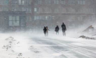
Tropical Storm Jerry is gaining strength in the Atlantic as it moves towards the Leeward Islands, while Priscilla, which has lost hurricane status, brings high surf and flood risks to Mexico’s Baja California. At the same time, a third system known as Octave continues to weaken further south in the Pacific, posing no threat to land.
The two major storm systems, one on each side of the Americas, are being closely monitored by the U.S. National Hurricane Center (NHC) as their impacts unfold in different regions. Jerry’s west-northwest trajectory could carry it toward populated islands in the Caribbean, while Priscilla’s downgraded status offers little relief from concerns over flash flooding in northwestern Mexico and the U.S. Southwest.
Priscilla Weakens but Still Triggers Coastal Alerts in Mexico
Tropical Storm Priscilla has been downgraded from hurricane status but remains active off the western Pacific coast of Mexico, according to the NHC. On Wednesday evening, the storm was positioned approximately 235 miles (378 km) west of the southern tip of Baja California, with maximum sustained winds of 60 mph (97 kph). It was moving northwest at 9 mph (14 kph).
Despite the loss of hurricane intensity, the storm continues to pose threats to Baja California Sur, particularly in the stretch between Cabo San Lucas and Cabo San Lázaro, where a tropical storm watch remains in effect. Forecasters have warned of high surf, gusty winds, and potentially heavy rainfall, which could lead to localised flash flooding in both coastal zones and inland regions over the weekend.
The storm’s moisture is also expected to feed into broader weather systems affecting the southwestern United States, increasing flood risks in already saturated areas. “The flood risk was increasing from all the rain Priscilla was dropping as it headed farther north.” the NHC stated.
Jerry Continues to Intensify in the Atlantic
In the Atlantic Ocean, Tropical Storm Jerry is showing signs of gradual strengthening. As of early Thursday, the system was located about 505 miles (813 km) east-southeast of the northern Leeward Islands, moving west-northwest at a speed of 18 mph (29 kph). Sustained winds were measured at 65 mph (105 kph), according to the latest advisory from the NHC.
Rainfall associated with Jerry is expected to affect several islands between Thursday and Friday, with 2 to 4 inches (5–10 cm) predicted in areas under tropical storm watch, including Antigua, Barbuda, Anguilla, St. Kitts, Nevis, Montserrat, St. Barts, St. Martin, Saba, St. Eustatius, and Guadeloupe.
The storm’s core is expected to pass close to these islands by late Thursday. Although not yet classified as a hurricane, forecasters have indicated that further development is possible in the coming days. The region remains on alert due to the risk of flash flooding and disrupted sea conditions. While Octave, another storm in the eastern Pacific, appears to be dissipating without reaching land, the presence of multiple active systems reinforces the need for preparedness as the hurricane season progresses.


