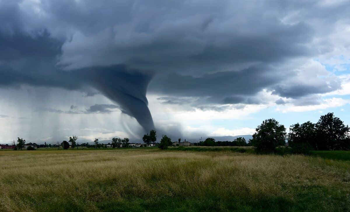
A violent storm system swept through the American Midwest on the night of March 10, killing at least two people and destroying homes across Illinois and Indiana. The outbreak, described by authorities as one of the most severe of the season, has left thousands without power and entire communities struggling to recover.
The hardest-hit community was Lake Village, Indiana, an unincorporated town roughly 60 miles southeast of Chicago, where an unconfirmed tornado carved directly through residential neighborhoods, trapping residents in collapsed structures and injuring several others. Rob Churchill, Lake Township Fire Chief, urged the public to keep their distance: “Lake Village took a direct hit, please stay away from the area.” North Newton Junior High School was opened as an emergency shelter, with school buses dispatched to ferry displaced residents from the fire department.
A Night of Unprecedented Severity
The scale of the outbreak was striking even by regional standards. At midnight Eastern time, according to the National Weather Service Storm Prediction Center, more than four million people remained under a tornado watch. The storms produced some of the largest hail recorded this season, with reports of grapefruit-sized stones and a verified measurement of 5.2-inch hail near Kankakee, Illinois, shared by a storm chaser with the weather service.
In Kankakee County, approximately 55 miles south of Chicago, a large tornado struck near the county fairgrounds before crossing the Kankakee River into Aroma Park, where weather service spotters observed “significant damage” with entire roofs torn off homes and 12-inch trees uprooted. More than 7,000 electricity customers lost power in Kankakee County alone, while neighboring Newton County saw 44% of its customers cut off from the grid. Flash flooding also struck as far east as Grand Rapids, Michigan, where six to ten inches of water covered Interstate 196.
The Threat Extends Into Wednesday
The severe weather system showed little sign of relenting by Wednesday morning. Tornado watches remained active across Ohio, Indiana, Kentucky and West Virginia, covering major metropolitan areas including Cleveland, Columbus and Cincinnati. West Virginia’s watch was extended until 5 p.m. local time, covering 23 counties.
AccuWeather meteorologist Brandon Buckingham told Newsweek that while the tornado risk had eased somewhat from the previous night, it had not passed. “The severe weather threat stretches from the Gulf Coast to upstate New York through late tonight,” he said, adding that “more tornadoes are possible” and urging residents to prepare shelters and secure vehicles against hail damage.
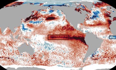
Contributing to the storm’s ferocity were unseasonably warm temperatures across the region. According to the National Weather Service, New York City’s Central Park recorded 80 degrees on March 10, the earliest such reading since records began in 1869, beating the previous record by three days. Rising sea surface temperatures in the Gulf of America added further moisture to an already volatile atmospheric setup, amplifying conditions that meteorologists say made this outbreak particularly dangerous.