A sharp drop in temperatures is sweeping across the eastern United States, as a powerful storm system pushes through the Northeast, bringing with it strong winds, heavy rain and even snow. The National Weather Service (NWS) and AccuWeather have both issued advisories for wide areas, warning of sharp wind chills and the possibility of snow in mountainous regions.
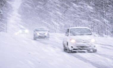
The snowfall, while not widespread, is expected to affect parts of seven states, from Pennsylvania to Maine, particularly in higher elevations. It comes as temperatures dip to their lowest so far this season, ending the growing season in parts of the South and affecting Weekend plans for millions across the region.
Snow Returns to the Northeast’s Higher Ground
According to AccuWeather, snowfall is expected late Friday into early Saturday across parts of southwestern Pennsylvania, northeastern West Virginia, northern New York, western Maryland, and across the higher elevations of Vermont, New Hampshire and Maine. Most of the affected areas are mountainous or rural, with accumulations generally light typically “a dusting to an inch”, though some places may see up to 3 inches.
Senior meteorologist Tom Kines, speaking to Newsweek, explained that while this is not the first snow of the season, “the higher ground up across the Adirondacks and into the mountains of New England during overnight hours and very early into tomorrow will likely see at least a dusting of snow.”
The snowfall coincides with a rapid descent in temperatures, with colder air moving in behind the storm front. According to NWS Burlington, rain is expected to transition to snow “around midnight for the Adirondacks,” with “increasingly windy and cool conditions” expected across eastern and southern Vermont.
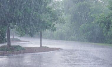
Beyond the snowfall, the storm’s wider impact is being felt across a much larger swath of the eastern U.S., with over46 million people under wind advisories as of Friday, according to the National Weather Service. These strong winds have already contributed to coastal flooding earlier in the week, particularly along parts of the East Coast.
The storm system is also ushering in December-like temperatures from the Midwest through to the Southeast. The NWS has issued frost and hard freeze warnings as far south as Texas and Alabama, advising residents to protect sensitive vegetation and bring pets indoors.
In an email statement, AccuWeather noted: “Temperatures will be low enough for a frost to a hard freeze from the Carolinas into the Southeast late Friday into early Saturday. This will likely end the growing season at least for the mountains of the Carolinas.” While flooding risks remain limited due to ongoing drought conditions, the NWS warned of “isolated urban runoff issues” in areas with significant leaf fall, where storm drains may be blocked.
La Niña Brings Contrast across Regional Forecasts
While localised snowfall and chill are grabbing headlines in the East, broader patterns reflect the influence of La Niña, now forecast to continue through November. According to the FOX Forecast Center, this climate phenomenon is driving a complex interplay of conditions, typically favouring warmer, drier weather in the southern U.S. and wetter, cooler patterns in the North.
The NOAA Climate Prediction Center expects above-average temperatures across the Central Plains and much of the West Coast, attributed to persistent high pressure. By contrast, the Northeast and Upper Midwest are likely to experience more frequent cold-air outbreaks.
Precipitation trends mirror this divide. The Pacific Northwest is expected to remain wetter than average, while regions such as the Southeast and Mid-Atlantic could see prolonged dry spells. Tuscaloosa, Alabama, for example, has received only 5.7 cm of rain this autumn, making it one of the driest on record.
The contrast is further heightened by the return of what meteorologists call the “second severe storm season.” Clashes between northern cold fronts and lingering southern warmth have already triggered tornadic activity in past Novembers, particularly across Texas, Oklahoma, and Arkansas. Although this year has so far seen fewer tornadoes—just 39 compared to an average of 50—conditions remain volatile.
Meanwhile, daylight hours continue to shrink following the end of daylight saving time. Clocks rolled back on 2 November, and most Americans are now experiencing earlier sunsets as the march toward winter deepens.