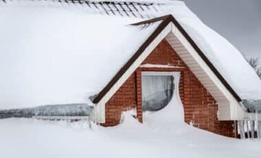
A Winter Storm Warning has been issued for several regions in Nevada and Wyoming, with heavy snowfalls, gusty winds, and hazardous travel conditions expected to impact the area. This warning, issued by the National Weather Service (NWS), is a significant reminder of the dangers posed by winter weather, particularly for travelers and residents in these mountainous areas. The snowstorm is expected to bring up to 10 to 11 inches of snow in certain regions of Nevada, while Wyoming will also face treacherous conditions.
Nevada Braces for Heavy Snowfall and Wind Gusts
In northern Nevada, the Winter Storm Warning is in effect for the Ruby Mountains and the East Humboldt Range in Elko County. Areas in these mountain ranges could receive up to 11 inches of snow.
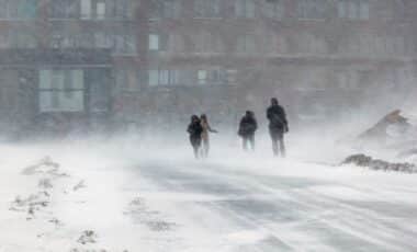
The snowstorm will not just be about accumulation — winds gusting up to 50 mph are expected along exposed ridgetops, compounding the hazards for anyone on the road. With snow-covered roads anticipated on State Route 229, particularly through Secret Pass and towards Lamoille Canyon, travel is expected to be extremely difficult, if not impossible, in some areas.
The NWS explained that they issue a Winter Storm Warning
“When a significant combination of hazardous winter weather is occurring or imminent.”
as is the case for the Ruby Mountains and East Humboldt Range. They also highlighted that winds will gust as high as 50 mph on exposed ridgetops and near the crest, making travel “extremely difficult or nearly impossible”.
Moreover, snow-covered roads are expected on major routes like State Route 229, particularly through Secret Pass, Lamoille Canyon, and Harrison Pass in the southern Ruby Mountains. Drivers in these areas should be prepared for severe weather conditions and avoid unnecessary travel.
The NWS also mentioned that snow levels will begin around 6,000 feet, before rising to 7,000 feet later in the day, with most of the precipitation expected in the afternoon. NWS Elko further posted on X:
“A storm system will impact Northern and Central Nevada this afternoon and tonight, resulting in periods of precipitation. Snow levels will start at around 6,000 feet, before rising to about 7,000 feet this afternoon. Most of this precipitation will fall this afternoon.”

Wyoming Faces Snowy Mountain Passes and Slick Roads
Meanwhile, the Winter Weather Advisories in Wyoming are in effect for several mountain ranges, including the Teton and Gros Ventre Mountains, as well as the Wind River Mountains and the Absaroka Mountains. These advisories indicate that 2 to 4 inches of snow, or a mix of snow and freezing rain, will cause significant inconvenience but may not be severe enough to warrant a Winter Storm Warning.
The Wind River Mountains are expecting between 3 to 6 inches of snow at elevations between 7,500 and 9,000 feet, with higher elevations possibly seeing up to 10 inches. Roads along mountain passes will likely be slick, making travel hazardous.
Outdoor enthusiasts and hikers are also urged to prepare for cold, wet conditions. While the storm should clear up by Thursday night, the NWS warns that another cold front could bring additional snow on Saturday, though it is expected to be lighter.
Chris Hattings, a meteorologist with the NWS forecast office in Riverton, Wyoming, told Newsweek:
“After the advisories expire on Thursday night, we are not anticipating any more advisories to be issued through the weekend. Another cold front may bring some more snow to the mountains on Saturday, but amounts are currently expected to be light. Otherwise, things should be mainly dry with temperatures close to seasonal normals.”