According to the National Weather Service (NWS), the warnings signal that residents in the affected regions should remain vigilant and be prepared to act quickly. The agency stressed that the evolving storm system carries the potential for rotating thunderstorms capable of producing tornadoes, posing a serious threat to communities in its path.
Areas under Warning across Southeast Louisiana and Mississippi
In southeast Louisiana, 12 parishes are under a tornado warning until Sunday morning. These include Jefferson, Lafourche, Orleans, Plaquemines, St. Bernard, St. Charles, St. James, St. John the Baptist, St. Tammany, Tangipahoa, Terrebonne, and Washington. The NWS has advised residents in these areas to remain on high alert as conditions continue to develop.
Mississippi is also facing widespread risk. According to the NWS, multiple counties in the southeast, southern, and east-central parts of the state have been instructed to prepare for a possible tornado. Clarke and Jasper counties in east-central Mississippi are among those listed.
In southeast Mississippi, George, Greene, Jefferson Davis, Covington, Forrest, Jones, and Lamar counties are included in the warning. Cities such as Bay Springs, Collins, Hattiesburg, Heidelberg, Laurel, Lumberton, Mount Olive, Purvis, Quitman, Shubuta, Stonewall, and West Hattiesburg fall within the affected zone. Farther south, Hancock, Harrison, Jackson, Pearl River, and Walthall counties are also under alert.
Coastal waters are not exempt. The warning extends to Lake Pontchartrain, Lake Maurepas, the Mississippi Sound, and coastal waters stretching from southeast Louisiana to coastal Mississippi. The NWS has emphasized that residents and mariners in these areas should closely monitor official updates as the situation unfolds.
Safety Guidance as Tornado Threat Persists
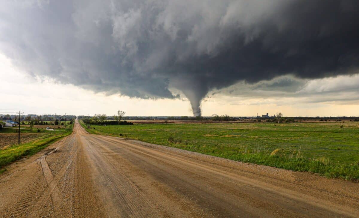
Tornadoes are rotating columns of air that form from thunderstorms, and their destructive force can be sudden and severe. According to the NWS, “tornadoes are capable of completely destroying well-made structures, uprooting trees, and hurling objects through the air like deadly missiles.” That characterization underscores the urgency of the current warnings.
Residents in affected areas are advised to continuously monitor local forecasts for updates. The NWS recommends establishing an emergency meeting plan and sharing it with family members, friends, and neighbors. Individuals should identify a designated safe space, such as a basement, cellar, or a windowless room on the ground or lower floor of a sturdy building. Churches and other solid structures may also provide refuge if needed.
The agency also urges people not to overlook pets and to check on elderly neighbors or vulnerable individuals who may require assistance. If a tornado strikes, those indoors should immediately move to their designated safe area, staying away from glass windows, doors, and large open rooms.
For anyone caught outside, the NWS advises seeking shelter in a sturdy building, noting that sheds, storage structures, tents, and mobile homes are not considered safe. If driving, individuals should head to the nearest secure building. If no shelter is available, they are advised to stop, position themselves in the lowest part of the vehicle while covering their heads, or exit and find protection in a ditch or ravine.