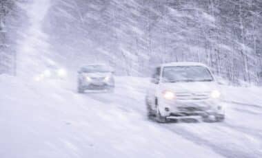
As Winter Storm Fern approaches the East Coast, forecasters say New York City could face more than six inches of snow starting Sunday. Meteorologists are closely watching the storm’s path, which is expected to bring hazardous conditions to at least 19 states.
A significant winter system is on track to hit large parts of the U.S. this weekend, stretching from the Southern Plains to the Northeast. In New York City, officials are warning residents to prepare for possible travel disruptions, dangerously cold temperatures, and heavy snow.
Forecast Models Suggest Over Six Inches of Snow in New York City
New York City is currently facing a 59 percent probability of receiving six inches or more of snow from Sunday into Monday, based on data released by the National Weather Service (NWS) New York office. Staten Island’s chances are slightly higher at 63 percent, while the Bronx sits at 53 percent. These figures reflect a growing concern among forecasters about the storm’s potential severity in the region.
The low-pressure system driving Winter Storm Fern is expected to pass south of New York, placing the city in a favorable zone for significant snowfall. According to the NWS forecast office in New York City, “There is a moderate potential we could exceed 6 inches of snow from a low pressure system that will pass to our south.” At this stage, no winter storm warnings or advisories have been issued, but that could change in the coming days as the storm draws nearer.
John Cristantello, lead meteorologist at the NWS New York office, told Newsweek that snowfall of this scale would be considered a “plowable” event, likely triggering a winter storm warning. He added that the main risk for the city will be “hazardous travel,” and warned that wind conditions could further complicate matters, possibly creating “blizzard conditions” and dangerously low wind chill temperatures.
Broader Storm Impacts Span Southern and Eastern U.S. Regions
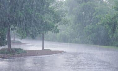
While New York is expected to receive measurable snow, the most severe impacts from Winter Storm Fern are projected further south. According to the Weather Channel meteorologist Jim Cantore, the storm has a “dangerous sweet spot” where heavy snow, freezing rain, and widespread power outages may converge, particularly from the southern Plains to the Southeast. In some regions, ice accumulation could exceed one inch, a level that poses a serious threat to power infrastructure and road safety.
Stephanie Abrams, also from the Weather Channel, described the system as a “plan-changing winter storm” that could disrupt travel and power in areas typically unaccustomed to severe winter weather. She noted the extended duration of cold temperatures following the storm, which could prolong ice-related hazards. According to Abrams, “What makes this storm especially dangerous is the lack of a warm-up afterward.”
The Weather Prediction Center of the NWS stated that “confidence continues to increase” in a major storm affecting much of the country between Friday and Sunday. While the risk of ice remains concentrated in the South, snow accumulation could reach into the Northeast, with New York’s chances for moderate winter storm impacts currently estimated between 40 and 50 percent.
According to AccuWeather senior meteorologist Adam Douty, the storm could become “one of the most impactful storms of the winter,” especially given its broad geographic reach and potential to affect areas with limited winter weather resources. New York residents are being urged to monitor local forecasts as the weekend approaches. If conditions continue on the current trajectory, travel could be severely impacted and schools or services may be disrupted at the start of next week.