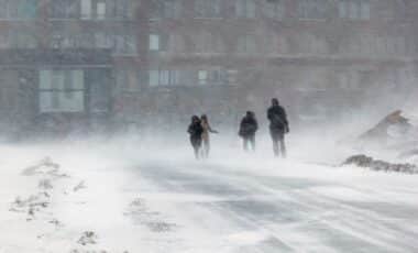
Authorities have issued winter storm warnings and advisories, with some of the most severe impacts expected through Wednesday. According to the National Weather Service (NWS), the storm is expected to continue, making travel difficult or even impossible in some regions.
This storm, which stretches from the West Coast to parts of the Northeast and Alaska, is one of the most significant weather events this winter. From heavy snowfall to reduced visibility, the storm is not only a safety concern for travelers but also for residents in the affected areas. Many local authorities have warned against unnecessary travel, urging residents to stay indoors while conditions improve.
California and Alaska Brace for Heavy Snow and Strong Winds
California and Alaska are among the hardest-hit states by this winter storm. According to the NWS, mountainous areas of California, including Yosemite National Park and parts of the San Joaquin River, are expecting as much as 24 inches of snow by Wednesday afternoon.
The heavy snow, combined with strong winds reaching up to 50 mph, is predicted to make travel nearly impossible. Yosemite National Park, a popular destination for winter tourists, is particularly vulnerable to the harsh conditions. The NWS has advised against non-essential travel in the area, as visibility could be reduced to near zero at times due to blowing snow.
In Alaska, parts of the Kuskokwim Delta are facing significant snowfall and dangerous winds, with up to 8 inches of snow and winds of up to 40 mph expected. Visibility in the region is expected to drop, making it difficult for vehicles to navigate the roads. The northern Bristol Bay Coast is also experiencing severe weather, with up to 12 inches of snow in some areas. These conditions are expected to last until Wednesday morning, with the worst snowfall occurring through the night. In these regions, the National Weather Service has emphasized that snow drifts and reduced visibility could pose serious risks to travelers.
Other States Affected by Snowfall and Dangerous Travel Conditions
While California and Alaska are at the forefront of the storm, several other states are also experiencing significant snowfall and travel disruptions. In Utah, the Wasatch and western Uinta Mountains could see up to 15 inches of snow, while the Centennial Mountains in Idaho are expected to receive between 4 and 11 inches of snow by Thursday.
Parts of New York are also preparing for the impact of the storm, with 6 to 11 inches of snow expected to fall in the higher parts of the Eastern Lake Ontario region. The NWS has warned that these conditions could affect commutes on both Tuesday and Wednesday, urging residents to remain cautious when traveling. Similarly, Maine, Wyoming, and Nevada are bracing for snow accumulation, with significant snowfall expected to disrupt traffic, especially in mountainous regions. In Nevada, snow totals could reach up to 12 inches above 7,000 feet in areas such as the greater Lake Tahoe region, with winds reaching 70 mph.
As the storm progresses, travelers and residents alike are urged to stay informed about changing conditions and to follow local guidance for safety. The storm serves as a reminder of the sometimes unpredictable and severe nature of winter weather across the United States, with conditions that can quickly turn hazardous, even for experienced drivers.