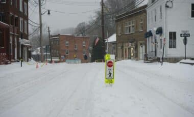
The upcoming storm marks the first significant snowfall of the season for the region. The winter weather is expected to blanket New York City, Long Island, and parts of Central New York, with snow accumulation varying across different areas. The event, which will continue into Sunday afternoon, could have far-reaching impacts on travel, local infrastructure, and daily life, as temperatures stay below freezing for the first part of the week.
Long Island to Receive Heaviest Snowfall
According to the National Weather Service, Long Island is likely to see the heaviest snowfall from this storm. Parts of Suffolk County could receive up to 7 inches of snow, making this the largest single-event snowfall in nearly four years. Snow is expected to begin around 8 p.m. on Saturday, with steady accumulation through the night and into Sunday morning.
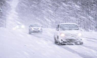
Suffolk County’s snow totals could reach the highest in the region, with areas like Islip forecasting 5 inches, the largest accumulation since a blizzard hit the region in January 2022. By Sunday morning, snow will likely fall at a rate of 1 inch per hour in some areas, according to meteorologists. The National Weather Service has issued a winter weather advisory for Long Island, emphasizing the hazardous travel conditions expected overnight, particularly on roads, bridges, and overpasses.
Mike Martino, a spokesperson for Suffolk County, confirmed that the county is ready for the snowstorm. He stated that the fleet of plows and salt trucks would be prepared to manage the accumulation and keep roads as clear as possible.
Snow, Ice, and Dangerous Travel Conditions Across the Tri-State Area
The storm’s impact will not be limited to Long Island. The wider tri-state area is also facing significant snowfall, with New York City expected to receive between 1 and 3 inches. Temperatures will drop below freezing as the storm moves in, with New York City bracing for lows in the upper 20s. The snow will fall at a moderate pace, starting at around 9 p.m. Saturday and tapering off by mid-morning on Sunday.
While the Big Apple will experience lighter snowfall, areas to the north, including Westchester County and parts of Central New Jersey, could see up to 5 inches. This storm will be especially impactful for commuters, with slick roads and low visibility likely to create dangerous driving conditions throughout the night. The New York City Emergency Management Department has activated its Winter Weather Emergency Plan to assist in managing snow removal and ensuring public safety.
In parts of Central New York, the storm will bring a different dynamic. Meteorologists warn of lake-effect snow, with the potential for up to 6 inches of accumulation in areas like Oswego County. Snowfall rates could reach up to 2 inches per hour, making travel hazardous through Sunday morning. The National Weather Service has issued warnings for several counties in Central New York, urging drivers to avoid unnecessary travel.
Temperatures will remain well below freezing through the beginning of the week. Sunday and Monday will see highs in the low 30s, with wind chills making it feel even colder. According to meteorologist Joe Pollina, the snow should stick around until at least Tuesday, as daytime temperatures struggle to rise above freezing. Relief is expected by Wednesday, with temperatures forecast to rise into the upper 40s, which should help melt some of the snow.