As snowstorms spread across multiple states, travel disruptions and hazardous conditions are expected to take hold. Meanwhile, meteorologists are closely monitoring the potential for a major cold snap brought on by the disruption of theAlaska , an event that could drastically alter the winter forecast for large swaths of the country. According to the National Weather Service (NWS), residents and travelers are advised to prepare for significant weather changes in the coming days.
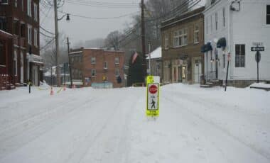
Winter Storm Warnings Across Multiple States
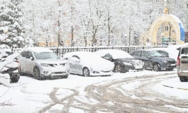
Several regions in the U.S. are now under winter storm warnings, with up to a foot of snow expected in certain areas. From Alaska to California, the storm is already making its presence felt. In Alaska, the Klondike Highway, particularly near White Pass, is bracing for up to 12 inches of snow, compounded by winds that could gust up to 50 mph, according to the NWS. Areas such as St. Lawrence Island and the Bering Strait Coast are expected to experience blizzard-like conditions, with winds that will reduce visibility, making travel even more perilous.
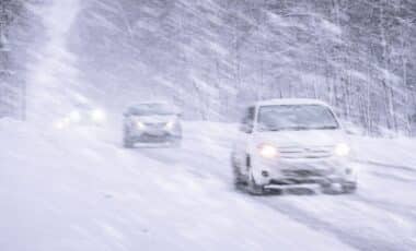
In the western U.S., high-altitude locations are preparing for heavy snowfalls as well. In California, Mono County could see up to 12 inches of snow above 7,000 feet, while the Sierra Nevada mountains may be hit with as much as 18 inches on the highest peaks. Gusty winds of up to 80 mph are expected along the Sierra crest, further complicating conditions.
Similarly, regions in Nevada, Colorado, and New Mexico are forecast to experience snow accumulations ranging from 4 to 8 inches at higher elevations, alongside fierce wind gusts that will impact visibility and create dangerous driving conditions. The NWS is urging travelers in these areas to stay informed and carry emergency supplies when traveling.
A Sudden Stratospheric Warming Event: A Chilly Forecast for December
In a less immediate but equally concerning development, meteorologists are tracking a sudden stratospheric warming (SSW) event, which is expected to disrupt the polar vortex and push frigid air from the Arctic southward into North America. SSW events, which are relatively rare in November, have the potential to trigger a significant shift in global weather patterns. While these events are not unprecedented, the occurrence of an SSW this early in the season is unusual, and it may lead to below-average temperatures across the U.S. from late November into December.
According to Amy Butler, a research scientist at the National Oceanic and Atmospheric Administration (NOAA), sudden stratospheric warming events can lead to persistent changes in weather that last for several weeks. The most notable impact of an SSW event is the displacement or elongation of the polar vortex, a region of cold, stormy air that typically stays confined to the Arctic. As the vortex weakens, cold air can spill southward, affecting the U.S. and other regions. This year, the northern U.S. and parts of southern Canada are likely to experience the brunt of the cold, with temperatures forecast to drop significantly after Thanksgiving.