A developing tropical weather system off the coast of northeastern Florida is raising concerns over potential heavy rainfall and minor flooding across parts of Florida and the northern Gulf Coast. Though not expected to become a significant cyclone, the disturbance is being closely monitored by the National Hurricane Center (NHC) due to its proximity to populated regions.
This meteorological development arrives at a time when the Atlantic hurricane season is entering a more active phase. While the current system shows limited signs of strengthening, the possibility of downpours and flash flooding over the coming days has prompted forecasters to issue early warnings, particularly as communities prepare for more volatile weather patterns.
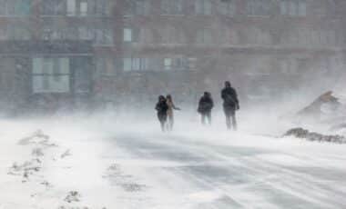
Forecast Shows Slow-moving Low-pressure Area off Florida Coast
As of the July 23 advisory from the NHC, the weather system is a broad area of low pressure accompanied by disorganized showers and thunderstorms. It is currently located off the northeastern Florida coastline and is expected to drift west-southwestward into the north-central Gulf of Mexico.
Forecast models indicate that the system could encounter slightly favorable environmental conditions during its movement across the Gulf. However, the NHC estimates only a 10% probability of tropical cyclone formation within the next seven days. Despite the low development potential, meteorologists warn that heavy rainfall is likely across Florida over the next 24 hours and could extend to the Gulf Coast by the weekend.
Low Development Potential Does not Eliminate Flooding Risks
While the system may never reach tropical storm classification, the rainfall threat remains substantial. Coastal and low-lying areas, particularly in northern Florida and along the Gulf Coast, could experience localized flooding from prolonged periods of rain.
The NHC emphasizes that storm formation is not required to produce significant weather impacts. The center of the storm system, often used to track intensity, does not represent the full range of possible hazards. According to the NHC, the center of a storm may fall outside the projected cone up to 33% of the time, highlighting the difficulty in predicting rainfall distribution and impact zones.
Another System Develops in the Eastern Pacific Near Hawaii
Alongside the Gulf system, the NHC is monitoring a separate low-pressure area in the eastern Pacific Ocean, expected to form southeast of the Hawaiian Islands. This second disturbance shows some signs of gradual development, with forecasters assigning it a 20% chance of tropical formation within a week.
Moving at 10 to 15 mph westward, this Pacific system currently poses no immediate threat to land but could influence marine conditions in the area. The NHC will continue to provide updates should it begin to organize into a more defined weather system.
Preparedness Measures Encouraged Amid Start of Peak Hurricane Season
The NHC and NOAA are urging residents in hurricane-prone areas to review preparedness plans as the tropical season progresses. Agencies recommend assembling disaster supply kits, reviewing insurance coverage, and finalizing evacuation routes in anticipation of future storms.
Flood insurance, often not included in standard homeowner policies, requires a 30-day waiting period, making early action especially critical. In addition, families are encouraged to document household possessions, identify communication plans, and consider physical reinforcements such as storm shutters and sealing exterior vulnerabilities.

Forecasters Continue Monitoring Despite Low Formation Probabilities
Although both the Gulf and Pacific systems currently exhibit low chances of cyclone development, their movement and structure are being closely tracked by forecasters. According to the National Hurricane Center, the potential for localized rain impacts persists regardless of whether the systems organize into named storms.
The coming days will determine whether environmental factors in the Gulf of Mexico support further organization. In the meantime, weather agencies advise communities to remain informed and proactive as conditions evolve.