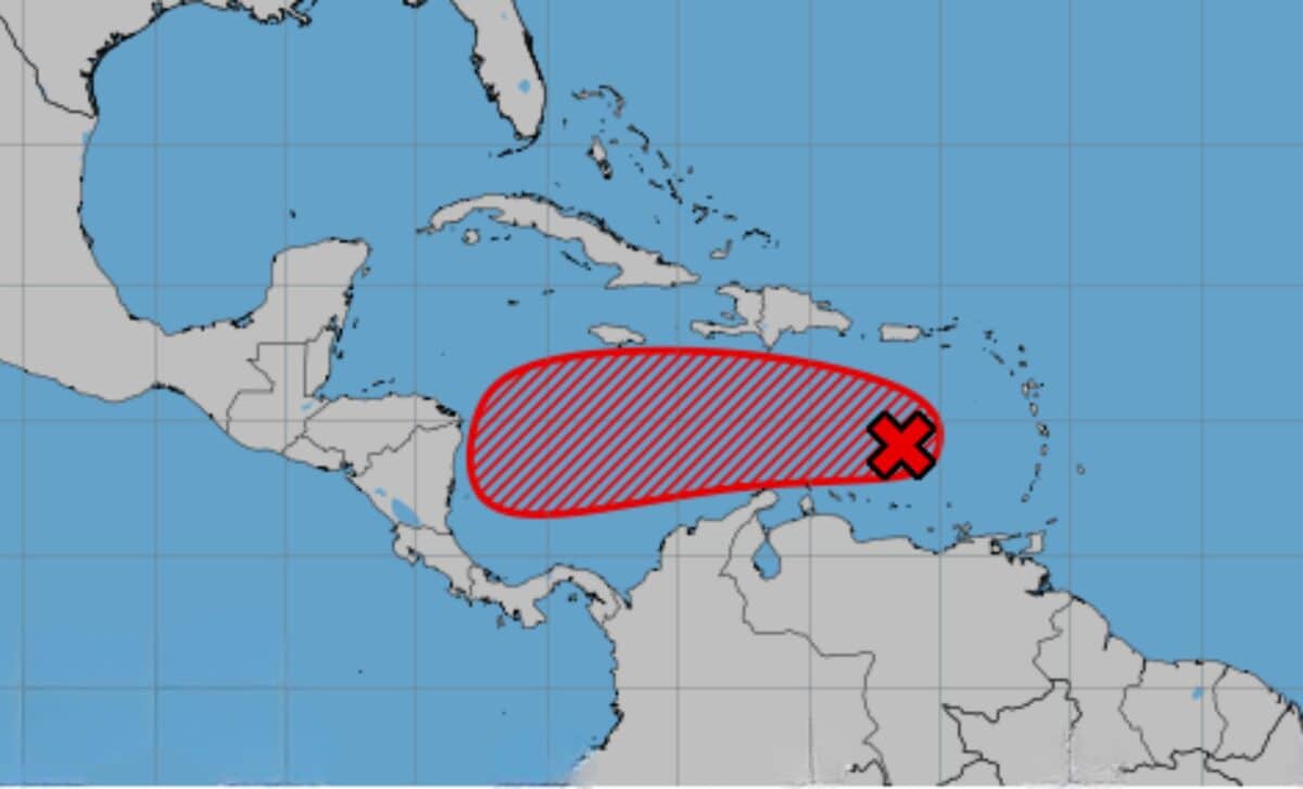
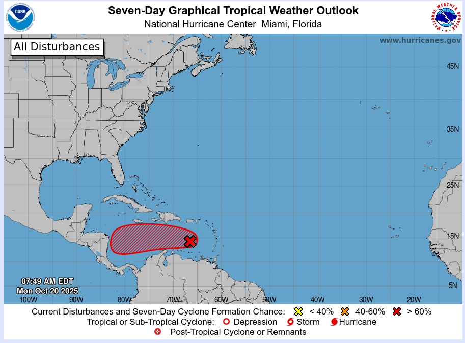
A tropical disturbance in the Caribbean Sea, currently known as 98L, is rapidly gaining attention as it tracks westward through the region. With the possibility of developing into a significant storm, meteorologists are closely monitoring its progression. The system, which could soon be named Melissa, holds the potential to bring heavy rains, strong winds, and dangerous seas to the Caribbean over the coming days. While its precise path remains uncertain, experts are weighing the risks for areas from Hispaniola to Central America.
Though no direct threat to the United States is anticipated at present, forecasters warn that the slow-moving nature of the storm could result in prolonged impacts for the islands in its path. Here’s what we know so far.
Storm Formation and Forecasts
According to the National Hurricane Center, 98L is situated in the Caribbean Sea, where sea surface temperatures are near 90°F—ideal conditions for intensification. Currently, the system holds a 70% chance of evolving into a named storm by midweek. If it does, the next name on the list is Melissa.
Early forecasts suggest that Puerto Rico and the Leeward Islands will begin experiencing heavier rainfall and thunderstorms from Monday onwards, as the disturbance moves westward. However, its exact trajectory remains unclear. The system is expected to either turn north, potentially impacting the Dominican Republic and Haiti, or continue heading westward towards Central America. The uncertainty of its path, combined with the system’s slow movement, means that affected areas could face prolonged periods of adverse weather conditions, including flooding and strong winds.
Potential Threats and Scenarios
Several potential scenarios are being considered by meteorologists, each with varying degrees of impact. If the storm shifts northward, Hispaniola—home to both Haiti and the Dominican Republic—could face severe weather conditions later this week, including possible flooding and storm surge. On the other hand, a westward path could bring the storm towards Nicaragua or Honduras early next week.
Although the U.S. East Coast is not likely to be impacted by this particular system, it remains important for those in the Caribbean and along the southeastern U.S. to keep a close eye on updates. The slow movement of the storm increases the risk of it stalling near land, extending the duration of its impacts.
While hurricane landfalls in the United States are rare in late October and November, the potential for further storms this season remains, particularly with the warm ocean conditions in the Atlantic and the La Niña phenomenon in the Pacific. As of now, however, the system is not expected to strengthen rapidly enough to pose a significant risk to the U.S. mainland. For now, those in the Caribbean and Central America should stay prepared and stay informed, as the situation continues to develop.