A broad flood watch is now active across much of upstate New York, as issued by the National Weather Service (NWS). The advisory, in effect from 11 a.m. Sunday through late Sunday night, warns of the potential for flash flooding due to intense and persistent thunderstorms.
The weather alert comes at a time when many areas are already experiencing elevated water levels from recent rainfall, raising concerns about the readiness of drainage systems in both urban and rural zones. Residents are being advised to closely monitor developments throughout the day.
Large Zone of Impact Includes 20 Counties
The NWS has outlined a wide area at risk, spanning regions from the Southern Tier to the Mohawk Valley. Counties affected include Monroe, Wayne, Northern Cayuga, Oswego, Livingston, Ontario, Allegany, and Lewis in the western and north-central parts of the state. Further east and south, the watch covers Onondaga, Madison, Oneida (both north and south sectors), Schuyler, Steuben, Seneca, Tompkins, Southern Cayuga, and Yates. In the Mohawk Valley, Southern Herkimer County is also included.
This widespread designation reflects the unpredictability and reach of the storm system, which is expected to pass repeatedly over certain localities, increasing the chance of localized flooding.
Rainfall Rates May Exceed One Inch Per Hour
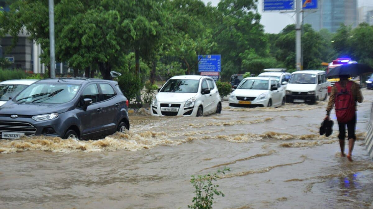
According to the alert, the main threat comes from slow-moving thunderstorms capable of generating rainfall rates at or above one inch per hour. Such rates, particularly if repeated over the same area, can rapidly overwhelm storm drains and small waterways.
The flash flood risk is especially elevated in low-lying locations, urban environments with aging drainage systems, and areas already saturated from recent rains. Emergency services are urging residents to be cautious and to avoid any unnecessary travel through vulnerable zones.
Storm movement will generally be northeast today. Storms are expected to continue to develop, likely peaking late this afternoon, early this evening.
— NYS Div. of Homeland Security & Emergency Services (@NYSDHSES) July 13, 2025
Severe winds up to 70 mph, large hail and tornadoes are possible. Flash flooding is likely where the heaviest rain occurs. pic.twitter.com/jvEO7YGAyk
Emergency Services Issue Public Safety Reminders
In coordination with the NWS, local agencies are asking residents to remain vigilant. Flash floods can develop with little notice, and driving through standing or fast-moving water is strongly discouraged. The advisory stresses the importance of heeding road closure signs and staying informed through official weather channels and local alerts.
The now-common refrain, “Turn around, don’t drown,” is once again being emphasized, especially for motorists approaching flooded intersections or underpasses. Road closures may be necessary as rainfall accumulates.

Drainage Systems and Urban Zones Under Pressure
Urban centers such as Rochester, Syracuse, and Ithaca may be especially vulnerable due to aging infrastructure and a higher density of impermeable surfaces. Local officials have warned that even short bursts of high-intensity rain can lead to temporary but dangerous flooding in city streets and parking areas.
Municipalities are monitoring critical drainage systems and preparing emergency response units in case water levels rise quickly. Residents in flood-prone areas are encouraged to review evacuation procedures and keep essential supplies accessible.